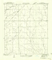
1956 Map of Beckwith School
USGS Topo · Published 1956About this map
Beckwith Sch serves as a central landmark for this rural portion of Beauregard Parish, where the timber industry has left a permanent mark on the landscape. The geography is defined by an extensive network of timber extraction routes, including the Old Logging Railroad Grade and numerous unnamed logging paths that weave between the primary drainage systems of Barnes Creek and Hickory Branch. These grades illustrate the era of intensive lumbering in the Louisiana pine forests, connecting remote areas to the broader market via the Kansas City Southern rail line.
Find a feature on this map
19 named features on this map. Tap any name to fly to it.
Don’t see what you’re looking for? This feature index may not catch every label — zoom into the map to look around manually.
Map Details
Editions of this 1956 Beckwith School Map
This is the sole edition of this map. No revisions or reprints were ever made.
Other maps of this area

1935 · Longville
USGS Topo · 1:31,680

1947 · Singer
USGS Topo · 1:31,680

1947 · Pujo
USGS Topo · 1:31,680

1947 · Oretta
USGS Topo · 1:31,680

1947 · DeRidder
USGS Topo · 1:31,680

1947 · Kernan
USGS Topo · 1:31,680

1947 · Ikes
USGS Topo · 1:31,680

1947 · Longville
USGS Topo · 1:31,680

1947 · Beckwith School
USGS Topo · 1:31,680

1947 · Bannister
USGS Topo · 1:31,680