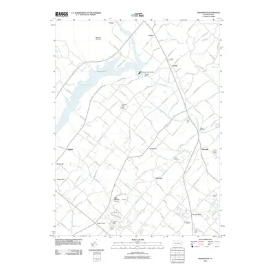
2010 Map of Bedminster
USGS Topo · Published 2010About this map
Lake Nockamixon dominates the northern landscape, its waters contained by the Tohickon Mill Dam and the Nockamixon State Park Dam along Tohickon Creek. This part of Bucks County preserves a mix of longstanding crossroads settlements and 20th-century residential growth. Historic sites like the Irish Meeting House and the Loux Covered Bridge near Pipersville anchor the local geography, while the Ottsville Post Office and Plumsteadville Post Office mark the continued importance of these traditional town centers. Small airfields such as Ridgeview Airport and Stefanik Airport are tucked between the drainages of Deep Run and Wolf Run, illustrating the region’s suburban character and private aviation history. The terrain is defined by low ridges like Maycock Mountain and distinctive outcrops such as Sentinal Rock, which overlook the parklands. Genealogy researchers can find many family-named roads and landmarks, including Kulps Corner, Keelersville, and Hagersville, alongside local resting places like Saint Johns Cemetery.
Find a feature on this map
109 named features on this map. Tap any name to fly to it.
Don’t see what you’re looking for? This feature index may not catch every label — zoom into the map to look around manually.
Map Details
Editions of this 2010 Bedminster Map
This is the sole edition of this map. No revisions or reprints were ever made.
Other maps of this area

1888 · Quakertown
USGS Topo · 1:62,500

1890 · Easton
USGS Topo · 1:62,500

1890 · Doylestown
USGS Topo · 1:62,500

1890 · Quakertown
USGS Topo · 1:62,500

1891 · Easton
USGS Topo · 1:62,500

1891 · Doylestown
USGS Topo · 1:62,500

1894 · Allentown
USGS Topo · 1:62,500

1894 · Quakertown
USGS Topo · 1:62,500

1932 · Easton
USGS Topo · 1:62,500

1939 · Allentown
USGS Topo · 1:62,500
Featured Places
- Hilltown Township, PA
- Bedminster Township, PA
- Tinicum Township, PA
- Nockamixon Township, PA
- Deep Run, Bedminster Township