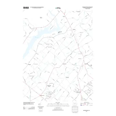
2013 Map of Bedminster
USGS Topo · Published 2013About this map
Lake Nockamixon and the surrounding woodlands of Nockamixon State Park dominate the northwestern portion of this Bucks County landscape. The area is characterized by a high concentration of private aviation facilities and rural road networks, including Stefanik Airport and several airstrips near Elephant. Significant local landmarks provide a look into the region's cultural geography, most notably the Irish Meeting House and the Loux Covered Bridge spanning Cabin Run. Higher elevations are defined by Maycock Mountain and the geological prominence of Sentinal Rock. Smaller residential clusters like Plumsteadville, Pipersville, and Meadow Lane Homes are linked by winding creeks such as Tohickon Cr and Deep Run, reflecting a modern mix of residential growth and preserved recreational land.
Find a feature on this map
161 named features on this map. Tap any name to fly to it.
Don’t see what you’re looking for? This feature index may not catch every label — zoom into the map to look around manually.
Map Details
Editions of this 2013 Bedminster Map
This is the sole edition of this map. No revisions or reprints were ever made.
Other maps of this area

1888 · Quakertown
USGS Topo · 1:62,500

1890 · Easton
USGS Topo · 1:62,500

1890 · Doylestown
USGS Topo · 1:62,500

1890 · Quakertown
USGS Topo · 1:62,500

1891 · Easton
USGS Topo · 1:62,500

1891 · Doylestown
USGS Topo · 1:62,500

1894 · Allentown
USGS Topo · 1:62,500

1894 · Quakertown
USGS Topo · 1:62,500

1932 · Easton
USGS Topo · 1:62,500

1939 · Allentown
USGS Topo · 1:62,500
Featured Places
- Hilltown Township, PA
- Bedminster Township, PA
- Tinicum Township, PA
- Nockamixon Township, PA
- Deep Run, Bedminster Township