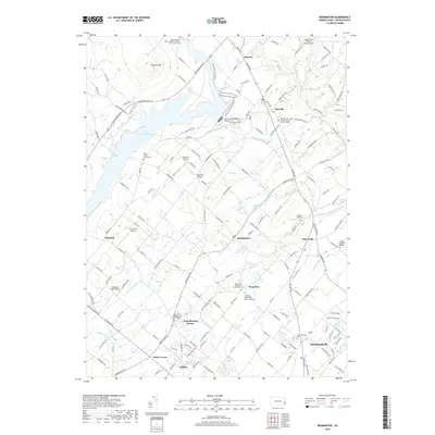
2019 Map of Bedminster
USGS Topo · Published 2019About this map
Bedminster and the surrounding Bucks County countryside are defined by a network of historic congregations and small airfields. This modern survey illustrates the proximity of the Deep Run Mennonite Church West Cem and Deep Run Mennonite Church East Cem, alongside the Deep Run Presbyterian Church Cem near Irish Meeting House. These sites, along with the Saint John the Baptist Roman Catholic Saint Johns Cem near Harrow, represent the deep-rooted community history of the region.
Find a feature on this map
156 named features on this map. Tap any name to fly to it.
Don’t see what you’re looking for? This feature index may not catch every label — zoom into the map to look around manually.
Map Details
Editions of this 2019 Bedminster Map
This is the sole edition of this map. No revisions or reprints were ever made.
Other maps of this area
1888 · Quakertown
USGS Topo · 1:62,500

1890 · Easton
USGS Topo · 1:62,500

1890 · Doylestown
USGS Topo · 1:62,500
1890 · Quakertown
USGS Topo · 1:62,500

1891 · Easton
USGS Topo · 1:62,500

1891 · Doylestown
USGS Topo · 1:62,500

1894 · Allentown
USGS Topo · 1:62,500
1894 · Quakertown
USGS Topo · 1:62,500
1932 · Easton
USGS Topo · 1:62,500
1939 · Allentown
USGS Topo · 1:62,500
Featured Places
- Hilltown Township, PA
- Bedminster Township, PA
- Tinicum Township, PA
- Nockamixon Township, PA
- Deep Run, Bedminster Township