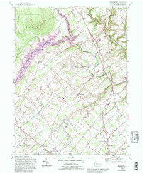
1992 Map of Bedminster
USGS Topo · Published 1995About this map
The rolling hills of northern Bucks County are defined by the winding course of Tohickon Creek, which expands into Nockamixon Lake within the Nockamixon State Park. This landscape reflects a long history of small-scale settlement, where narrow valleys like those of Mink Run and Deep Run are punctuated by crossroads hamlets such as Elephant, Pipersville, and Harrow. The terrain is dominated by Haycock Mtn and the heavily wooded State Game Lands No 157 in the north, providing a stark contrast to the agricultural patterns found in the southern townships of Bedminster and Plumstead. Significant community landmarks, including the Irish Meeting House and the St Johns Ch, speak to the deep religious roots of the area, while historical schoolhouses like Clay Ridge Sch and Smith Sch illustrate the decentralized rural education system that once served these dispersed farming families.
Find a feature on this map
44 named features on this map. Tap any name to fly to it.
Don’t see what you’re looking for? This feature index may not catch every label — zoom into the map to look around manually.
Map Details
Editions of this 1992 Bedminster Map
This is the sole edition of this map. No revisions or reprints were ever made.
Other maps of this area

1888 · Quakertown
USGS Topo · 1:62,500

1890 · Easton
USGS Topo · 1:62,500

1890 · Doylestown
USGS Topo · 1:62,500

1890 · Quakertown
USGS Topo · 1:62,500

1891 · Easton
USGS Topo · 1:62,500

1891 · Doylestown
USGS Topo · 1:62,500

1894 · Allentown
USGS Topo · 1:62,500

1894 · Quakertown
USGS Topo · 1:62,500

1932 · Easton
USGS Topo · 1:62,500

1939 · Allentown
USGS Topo · 1:62,500
Featured Places
- Hilltown Township, PA
- Bedminster Township, PA
- Tinicum Township, PA
- Haycock Township, PA
- Irish Meeting House, Bedminster Township