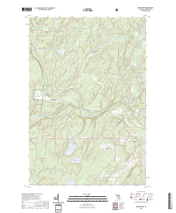
2023 Map of Beechwood
USGS Topo · Published 2023About this map
The Ottawa National Forest dominates this section of Iron County, where the South Branch Paint River carves a winding path through the timberlands. This waterway, designated here as the Paint Wild and Scenic River, is fed by numerous tributaries including Cooks Run and McRae Creek. The map documents a landscape defined by its hydrography, featuring isolated water bodies such as Silver Lake, Timber Lake, and Homan Lake. The small settlement of Basswood serves as a localized hub near Basswood Pond, while Rosehill Cem provides a point of genealogical interest near Merriman Lake. An extensive network of forest roads and trails, including the Canoe Cooks Run Trl, indicates a region managed for both conservation and active forest use, with the Farm Service Agency Interest of Michigan maintaining a presence in the southeastern township.
Find a feature on this map
84 named features on this map. Tap any name to fly to it.
Don’t see what you’re looking for? This feature index may not catch every label — zoom into the map to look around manually.
Map Details
Editions of this 2023 Beechwood Map
This is the sole edition of this map. No revisions or reprints were ever made.
Other maps of this area

1895 · Perch Lake
USGS Topo · 1:62,500

1898 · Iron River
USGS Topo · 1:62,500

1944 · Iron River
USGS Topo · 1:24,000

1945 · Gibbs City
USGS Topo · 1:24,000

1946 · Iron River
USGS Topo · 1:31,680

1946 · Gibbs City
USGS Topo · 1:31,680

1954 · Kenton
USGS Topo · 1:62,500

1954 · Perch Lake
USGS Topo · 1:62,500

1956 · Beechwood
USGS Topo · 1:62,500

1958 · Iron River
USGS Topo · 1:250,000