
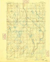
1895 Map of Perch Lake
USGS Topo · Published 1895About this map
Glacial lakes and meandering river branches dominate this Upper Peninsula wilderness during the late 19th-century logging era. The Perch Lake area is defined by its complex hydrology, where the North Branch of Net River and the Net River proper cut through a landscape of wetlands and small basins. Transportation through this remote terrain was governed by industrial rail expansion, most notably the Chicago Milwaukee and St. Paul R. R. Lake Superior Division, which traverses the center of the sheet.
Find a feature on this map
18 named features on this map. Tap any name to fly to it.
Don’t see what you’re looking for? This feature index may not catch every label — zoom into the map to look around manually.
Map Details
Editions of this 1895 Perch Lake Map
3 editions found
Other maps of this area

1895 · Ned Lake
USGS Topo · 1:62,500

1898 · Iron River
USGS Topo · 1:62,500

1899 · Crystal Falls
USGS Topo · 1:62,500

1945 · Gibbs City
USGS Topo · 1:24,000

1945 · Sunset Lake
USGS Topo · 1:24,000

1945 · Amasa
USGS Topo · 1:24,000

1946 · Sunset Lake
USGS Topo · 1:31,680

1946 · Gibbs City
USGS Topo · 1:31,680
1947 · Amasa
USGS Topo · 1:24,000

1954 · Rousseau
USGS Topo · 1:62,500