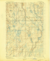
1895 Map of Perch Lake
USGS Topo · Published 1925About this map
Perch Lake anchors this Upper Peninsula wilderness, located at the meeting point of several early townships and county borders. The landscape is defined by its complex hydrology, where the Perch River, North Branch Net River, and the southern Paint River carve through the timberlands. During this late 19th-century era, the region was split among large land tracts including Atkinson, Hematite, Bates, L' Anse, and Duncan.
Find a feature on this map
23 named features on this map. Tap any name to fly to it.
Don’t see what you’re looking for? This feature index may not catch every label — zoom into the map to look around manually.
Map Details
Editions of this 1895 Perch Lake Map
3 editions found
Other maps of this area

1895 · Ned Lake
USGS Topo · 1:62,500

1895 · Perch Lake
USGS Topo · 1:62,500

1898 · Iron River
USGS Topo · 1:62,500

1899 · Crystal Falls
USGS Topo · 1:62,500

1945 · Gibbs City
USGS Topo · 1:24,000

1945 · Sunset Lake
USGS Topo · 1:24,000

1945 · Amasa
USGS Topo · 1:24,000

1946 · Sunset Lake
USGS Topo · 1:31,680

1946 · Gibbs City
USGS Topo · 1:31,680
1947 · Amasa
USGS Topo · 1:24,000