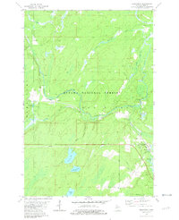
1981 Map of Beechwood
USGS Topo · Published 1981About this map
The Ottawa National Forest dominates the interior of Iron County, Michigan, in this early 1980s landscape defined by timber, rail, and water. The small settlement of Beechwood serves as a local hub near the intersection of Old Beechwood Road and the Chicago and North Western rail line. Genealogists will find significant local history at the Rosehill Cem and Bethany Ch, while the inclusion of the Townhall marks the civic center for the surrounding rural community.
Find a feature on this map
33 named features on this map. Tap any name to fly to it.
Don’t see what you’re looking for? This feature index may not catch every label — zoom into the map to look around manually.
Map Details
Editions of this 1981 Beechwood Map
This is the sole edition of this map. No revisions or reprints were ever made.
Other maps of this area

1895 · Perch Lake
USGS Topo · 1:62,500

1898 · Iron River
USGS Topo · 1:62,500

1944 · Iron River
USGS Topo · 1:24,000

1945 · Gibbs City
USGS Topo · 1:24,000

1946 · Iron River
USGS Topo · 1:31,680

1946 · Gibbs City
USGS Topo · 1:31,680

1954 · Kenton
USGS Topo · 1:62,500

1954 · Perch Lake
USGS Topo · 1:62,500

1956 · Beechwood
USGS Topo · 1:62,500

1958 · Iron River
USGS Topo · 1:250,000