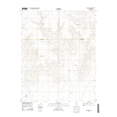
2013 Map of Beenham SW
USGS Topo · Published 2013About this map
Campbell and Harlan Vigil anchor this high-plains landscape in Northeastern New Mexico. The boundary between Union and Harding Counties bisects the terrain, illustrating the persistent importance of the Public Land Survey System as township lines such as t22n r30e and t21n r31e organize the cattle country. Water is a defining scarce resource here, with drainage represented by Church Cr in the north and Ventanas Cr to the southeast. Roads like Campbell Rd and Gallagher Rd provide the primary connective tissue between isolated rural settlements like Timmons. The land is marked by distinct geographical features, notably the Cerrito de los Muertos in the southwest corner, reflecting the deep cultural and topographic history of this segment of the Llano Estacado region.
Find a feature on this map
15 named features on this map. Tap any name to fly to it.
Don’t see what you’re looking for? This feature index may not catch every label — zoom into the map to look around manually.
Map Details
Editions of this 2013 Beenham SW Map
This is the sole edition of this map. No revisions or reprints were ever made.
Other maps of this area

1954 · Tucumcari
USGS Topo · 1:250,000

1954 · Dalhart
USGS Topo · 1:250,000

1958 · Tucumcari
USGS Topo · 1:250,000

1958 · Dalhart
USGS Topo · 1:250,000

1962 · Dalhart
USGS Topo · 1:250,000

1973 · Bueyeros NE
USGS Topo · 1:24,000

1973 · Yates SE
USGS Topo · 1:24,000

1973 · Garcia Creek
USGS Topo · 1:24,000

1973 · Beenham
USGS Topo · 1:24,000
1973 · Minnie Butte
USGS Topo · 1:24,000