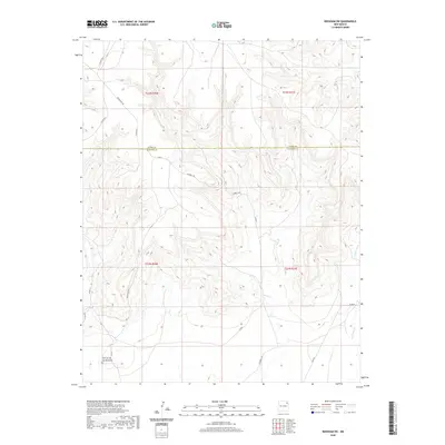
2020 Map of Beenham SW
USGS Topo · Published 2020About this map
The Union County and Harding County line bisects this high-plains landscape, where the terrain is defined by the sharp draws and drainages of Church Creek and Ventanas Creek. In the southwestern corner, the distinctive landform of Cerrito de los Muertos stands as a prominent landmark above the surrounding flats. This region is sparsely settled, characterized by a grid of county roads and historic grazing lands that reflect the expansive ranching heritage of northeastern New Mexico.
Find a feature on this map
19 named features on this map. Tap any name to fly to it.
Don’t see what you’re looking for? This feature index may not catch every label — zoom into the map to look around manually.
Map Details
Editions of this 2020 Beenham SW Map
This is the sole edition of this map. No revisions or reprints were ever made.
Other maps of this area

1954 · Tucumcari
USGS Topo · 1:250,000

1954 · Dalhart
USGS Topo · 1:250,000

1958 · Tucumcari
USGS Topo · 1:250,000

1958 · Dalhart
USGS Topo · 1:250,000

1962 · Dalhart
USGS Topo · 1:250,000

1973 · Bueyeros NE
USGS Topo · 1:24,000

1973 · Yates SE
USGS Topo · 1:24,000

1973 · Garcia Creek
USGS Topo · 1:24,000

1973 · Beenham
USGS Topo · 1:24,000
1973 · Minnie Butte
USGS Topo · 1:24,000