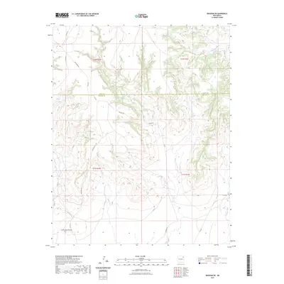
2023 Map of Beenham SW
USGS Topo · Published 2023About this map
Cerrito de los Muertos rises above the high plains where the border between Union County and Harding County meets. This 2023 survey documents a remote landscape defined by its deep arroyos and a network of county roads like Pasamonte Rd and Gallagher Rd that serve the area's sprawling ranchlands. The topography is shaped by the drainage patterns of Church Creek in the north and Ventanas Creek in the southeast, revealing the subtle relief of the northeastern New Mexico plateau. This modern topographic study provides an essential baseline for understanding contemporary land use and property boundaries within the Public Land Survey System, including sections of t21n r30e and t22n r31e.
Find a feature on this map
18 named features on this map. Tap any name to fly to it.
Don’t see what you’re looking for? This feature index may not catch every label — zoom into the map to look around manually.
Map Details
Editions of this 2023 Beenham SW Map
This is the sole edition of this map. No revisions or reprints were ever made.
Other maps of this area

1954 · Tucumcari
USGS Topo · 1:250,000

1954 · Dalhart
USGS Topo · 1:250,000

1958 · Tucumcari
USGS Topo · 1:250,000

1958 · Dalhart
USGS Topo · 1:250,000

1962 · Dalhart
USGS Topo · 1:250,000

1973 · Bueyeros NE
USGS Topo · 1:24,000

1973 · Yates SE
USGS Topo · 1:24,000

1973 · Garcia Creek
USGS Topo · 1:24,000

1973 · Beenham
USGS Topo · 1:24,000
1973 · Minnie Butte
USGS Topo · 1:24,000