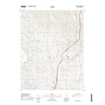
2017 Map of Belews Creek
USGS Topo · Published 2017About this map
Hillsboro anchor the southern portion of this landscape, situated near the campus of Jefferson College. This map captures the intricate drainage patterns of the Belews Creek watershed, which is defined by a dense concentration of residential lake developments and rural communities. In the north, Regina and Otto sit amidst a network of winding roads, while central features include the waters of Lake Tishomingo and Lake Bo-No-Del. The eastern section is marked by Goldman and the residential area of Granada Meadows. The terrain is characterized by narrow ridges like Sand Ridge and numerous creek systems, including Sandy Cr and Heads Cr. Cultural landmarks such as Highland Baptist Church Rd reflect the established local community during this era, while the winding Old Hwy 21 provides a trace of historical transportation routes through this part of Jefferson County.
Find a feature on this map
39 named features on this map. Tap any name to fly to it.
Don’t see what you’re looking for? This feature index may not catch every label — zoom into the map to look around manually.
Map Details
Editions of this 2017 Belews Creek Map
This is the sole edition of this map. No revisions or reprints were ever made.
Other maps of this area

1901 · De Soto
USGS Topo · 1:125,000

1912 · Kimmswick
USGS Topo · 1:62,500

1915 · Crystal City
USGS Topo · 1:62,500

1916 · Kimmswick
USGS Topo · 1:62,500

1930 · De Soto NE
USGS Topo · 1:24,000

1930 · Pacific SE
USGS Topo · 1:24,000

1931 · Pacific NE
USGS Topo · 1:24,000

1937 · Pacific
USGS Topo · 1:24,000

1937 · Fletcher
USGS Topo · 1:24,000

1938 · Cedar Hill
USGS Topo · 1:24,000