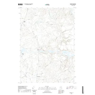
2019 Map of Belfort
USGS Topo · Published 2019About this map
The Beaver River and Indian River define this corner of Lewis County, where water resources have long driven local activity. Small settlements like Belfort and Kirschnerville are connected by a network of rural routes, including the historically resonant Erie Canal Rd. The landscape is notably shaped by hydro-infrastructure, featuring a sequence of impoundments such as Carthage Reservoir, Croghan Reservoir, and Effley Falls Pond. These reservoirs, along with High Falls and Elmer Falls, indicate a terrain where river gradients were harnessed for power and water management.
Find a feature on this map
60 named features on this map. Tap any name to fly to it.
Don’t see what you’re looking for? This feature index may not catch every label — zoom into the map to look around manually.
Map Details
Editions of this 2019 Belfort Map
This is the sole edition of this map. No revisions or reprints were ever made.
Other maps of this area

1911 · Lowville
USGS Topo · 1:62,500

1912 · Number Four
USGS Topo · 1:62,500

1913 · Lowville
USGS Topo · 1:62,500

1913 · Lake Bonaparte
USGS Topo · 1:62,500

1915 · Number Four
USGS Topo · 1:62,500

1916 · Lake Bonaparte
USGS Topo · 1:62,500

1916 · Oswegatchie
USGS Topo · 1:62,500

1918 · Oswegatchie
USGS Topo · 1:62,500

1948 · Ogdensburg
USGS Topo · 1:250,000

1950 · Utica
USGS Topo · 1:250,000