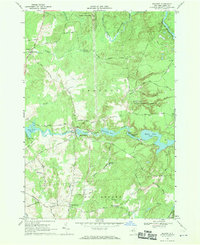
1966 Map of Belfort
USGS Topo · Published 1970About this map
The Beaver River powers a series of industrial sites and scenic waterscapes in this mid-1960s study of the Lewis County landscape. At Belfort, a central hydroelectric hub is evident, featuring a Powerplant, substation, and the Belfort Pond. The river's flow is further harnessed downstream and upstream at High Falls and Effley Falls, creating a chain of reservoirs including Taylorville Pond and Effley Falls Pond. These hydraulic developments are set against the heavily wooded backdrop of the State Forest Preserve and the western edge of Adirondack State Park.
Find a feature on this map
68 named features on this map. Tap any name to fly to it.
Don’t see what you’re looking for? This feature index may not catch every label — zoom into the map to look around manually.
Map Details
Editions of this 1966 Belfort Map
2 editions found
Other maps of this area

1911 · Lowville
USGS Topo · 1:62,500

1912 · Number Four
USGS Topo · 1:62,500

1913 · Lowville
USGS Topo · 1:62,500

1913 · Lake Bonaparte
USGS Topo · 1:62,500

1915 · Number Four
USGS Topo · 1:62,500

1916 · Lake Bonaparte
USGS Topo · 1:62,500

1916 · Oswegatchie
USGS Topo · 1:62,500

1918 · Oswegatchie
USGS Topo · 1:62,500

1948 · Ogdensburg
USGS Topo · 1:250,000

1950 · Utica
USGS Topo · 1:250,000