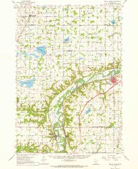
1957 Map of Belle Plaine
USGS Topo · Published 1968About this map
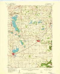
The Minnesota River cuts a wide, winding valley through this mid-century landscape, serving as the border for Carver, Sibley, Scott, and Le Sueur counties. This river-dominated geography is anchored by the established settlements of Belle Plaine and Henderson, where the Chicago And North Western and Minneapolis And ST Louis railroads track the water's edge. The agricultural uplands are densely dotted with evidence of early German and Irish settlement, featuring several traditional country schools like Zion Sch and School No 24, alongside numerous religious landmarks such as St Thomas Ch and West Union Ch. Unusual local features include the Jessenland (Fish Hatchery) near High Island, while the presence of Henderson Station apart from the town itself illustrates the specific influence of rail logistics on river valley development.
Find a feature on this map
70 named features on this map. Tap any name to fly to it.
Don’t see what you’re looking for? This feature index may not catch every label — zoom into the map to look around manually.
Map Details
Editions of this 1957 Belle Plaine Map
2 editions found
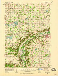
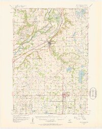
Other maps of this area

1905 · Minnetonka
USGS Topo · 1:62,500

1907 · Minnetonka
USGS Topo · 1:62,500

1953 · Saint Paul
USGS Topo · 1:250,000

1953 · New Ulm
USGS Topo · 1:250,000

1957 · New Ulm
USGS Topo · 1:250,000
1957 · Belle Plaine
USGS Topo · 1:62,500
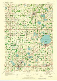
1957 · Waconia
USGS Topo · 1:62,500
1957 · New Prague
USGS Topo · 1:62,500

1958 · New Ulm
USGS Topo · 1:250,000
1958 · Gaylord
USGS Topo · 1:62,500