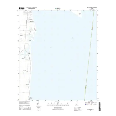
2014 Map of Bellefontaine
USGS Topo · Published 2014About this map
Belle Fontaine and the residential clusters of the Alabama coast define this survey of the western shore of Mobile Bay. The landscape is dominated by a complex network of coastal waterways, where Mon Louis Island is separated from the mainland by the meandering course of the East Foul River, Austin Bayou, and Delchamps Bayou. The map illustrates the specialized infrastructure of the bay, from the precisely dredged Mobile Ship Channel to the man-made expanse of Gaillard Island in the open water.
Find a feature on this map
42 named features on this map. Tap any name to fly to it.
Don’t see what you’re looking for? This feature index may not catch every label — zoom into the map to look around manually.
Map Details
Editions of this 2014 Bellefontaine Map
This is the sole edition of this map. No revisions or reprints were ever made.
Other maps of this area

1921 · Point Clear
USGS Topo · 1:62,500

1921 · Fairhope
USGS Topo · 1:62,500

1921 · Delchamps
USGS Topo · 1:62,500

1922 · Mobile
USGS Topo · 1:62,500

1939 · Daphne
USGS Topo · 1:31,680

1940 · Hollingers Island
USGS Topo · 1:31,680

1940 · Mobile
USGS Topo · 1:62,500

1941 · Daphne
USGS Topo · 1:31,680

1941 · Cedar Point
USGS Topo · 1:62,500

1941 · Weeks Bay
USGS Topo · 1:62,500