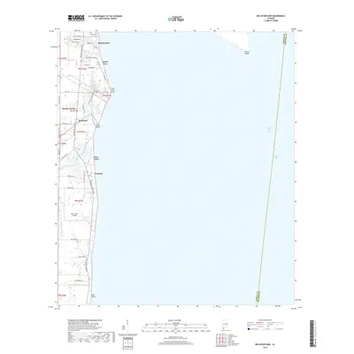
2018 Map of Bellefontaine
USGS Topo · Published 2018About this map
Mon Louis Island dominates the coastal landscape of Mobile County in this recent survey, showing the complex network of waterways that define the western edge of Mobile Bay. The interior is crisscrossed by tidal passages such as Delchamps Bayou and Whitehouse Bayou, while the eastern shore is marked by small residential communities like Bellefontaine, Sunny Cove, and Faustinas. Historically significant sites like the Mathis Cem near the northern boundary provide genealogical anchors for the area.
Find a feature on this map
48 named features on this map. Tap any name to fly to it.
Don’t see what you’re looking for? This feature index may not catch every label — zoom into the map to look around manually.
Map Details
Editions of this 2018 Bellefontaine Map
This is the sole edition of this map. No revisions or reprints were ever made.
Other maps of this area

1921 · Point Clear
USGS Topo · 1:62,500

1921 · Fairhope
USGS Topo · 1:62,500

1921 · Delchamps
USGS Topo · 1:62,500

1922 · Mobile
USGS Topo · 1:62,500

1939 · Daphne
USGS Topo · 1:31,680

1940 · Hollingers Island
USGS Topo · 1:31,680

1940 · Mobile
USGS Topo · 1:62,500

1941 · Daphne
USGS Topo · 1:31,680

1941 · Cedar Point
USGS Topo · 1:62,500

1941 · Weeks Bay
USGS Topo · 1:62,500