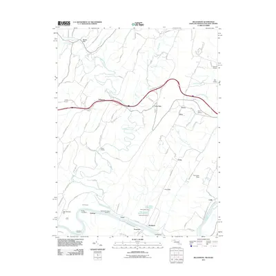
2011 Map of Bellegrove
USGS Topo · Published 2011About this map
Sideling Hill Creek carves a deep path through the ridges of western Maryland and West Virginia, meeting the Potomac River at a point marked by the Sideling Hill Creek Aqueduct. This corridor demonstrates the complex intersection of early transport and rugged topography, featuring the Indigo Tunnel and the path of the Western Maryland Rail Trl winding along the riverbank. Small communities like Bellegrove, Pearre, and Woodmont serve as quiet anchors in a landscape defined by significant elevation changes, from High Germany Hill to the steep ravines of Swain Hollow. The presence of Saint Pauls Cemetery and Mount Olivet Cemetery provides specific points of interest for those tracing local lineage near settlements like Harvey and Mann, while the river's edge is dotted with recreational landmarks such as Turkey Foot Bend and Indigo Neck Campground.
Find a feature on this map
93 named features on this map. Tap any name to fly to it.
Don’t see what you’re looking for? This feature index may not catch every label — zoom into the map to look around manually.
Map Details
Editions of this 2011 Bellegrove Map
This is the sole edition of this map. No revisions or reprints were ever made.
Other maps of this area

1898 · Paw Paw
USGS Topo · 1:62,500

1899 · Hancock
USGS Topo · 1:62,500

1900 · Pawpaw
USGS Topo · 1:62,500

1901 · Hancock
USGS Topo · 1:62,500

1910 · Paw Paw
USGS Topo · 1:62,500

1925 · Needmore
USGS Topo · 1:48,000

1927 · Clearville
USGS Topo · 1:48,000

1931 · Clearville
USGS Topo · 1:62,500

1935 · Needmore
USGS Topo · 1:62,500

1939 · Needmore
USGS Topo · 1:62,500