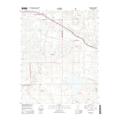
2014 Map of Bellemont
USGS Topo · Published 2014About this map
Bellemont serves as the primary focal point of this high-altitude landscape, situated where the open expanse of Bellemont Flat meets the dense woodlands of the Kaibab National Forest. The map documents a complex system of water management essential for this arid region, featuring a high concentration of artificial catchments and natural water sources. Notable water features include Rogers Lake, Budweiser Tank, and Reservoir Number One, while historic springs such as Ebert Spring and Paterson Spring dot the terrain. The topography is defined by significant elevations like Woody Mtn and Sliker Hill, intersected by Volunteer Canyon and the winding Volunteer Wash. Large portions of the area fall under the jurisdiction of the Coconino National Forest, illustrating the intersection of public land management and local infrastructure in northern Arizona during the early 21st century.
Find a feature on this map
50 named features on this map. Tap any name to fly to it.
Don’t see what you’re looking for? This feature index may not catch every label — zoom into the map to look around manually.
Map Details
Editions of this 2014 Bellemont Map
This is the sole edition of this map. No revisions or reprints were ever made.
Other maps of this area

1886 · San Francisco Mtns
USGS Topo · 1:250,000

1891 · San Francisco Mtns
USGS Topo · 1:250,000

1894 · San Francisco Mtns
USGS Topo · 1:250,000

1899 · San Francisco Mtns
USGS Topo · 1:250,000

1908 · Flagstaff
USGS Topo · 1:125,000

1912 · Flagstaff
USGS Topo · 1:125,000

1947 · Flagstaff
USGS Topo · 1:250,000

1954 · Flagstaff
USGS Topo · 1:250,000

1958 · Flagstaff
USGS Topo · 1:250,000

1960 · Flagstaff
USGS Topo · 1:250,000