Loading...
Loading map...2024 Map of Bellflower
USGS Topo · Published 2024About this map
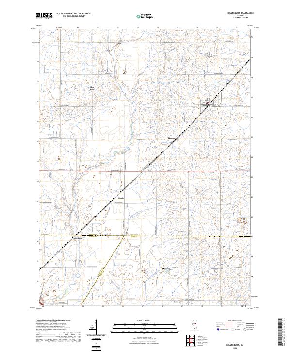
Bellflower serves as the primary hub in this central Illinois landscape, situated at the junction of Kleinbeck St and Center St. The surrounding terrain is defined by a series of small agricultural settlements and a complex drainage network that includes the winding path of Salt Creek and the Blue Ridge Special Creek. These watercourses, along with Trenkle Slough and Madden Creek, dictate the placement of local roads and farmsteads.
Find a feature on this map
28 named features on this map. Tap any name to fly to it.
Don’t see what you’re looking for? This feature index may not catch every label — zoom into the map to look around manually.
Map Details
Date Portrayed2024
Date Published2024
PublisherU.S. Geological Survey
Map TypeTopographic
Scale1:24000
Physical Dimensions24 x 29 inches
Editions of this 2024 Bellflower Map
This is the sole edition of this map. No revisions or reprints were ever made.
Historical Maps of Kumler Through Time
Featured Locations
Source Details
SourceU.S. Geological Survey
CopyrightPublic Domain