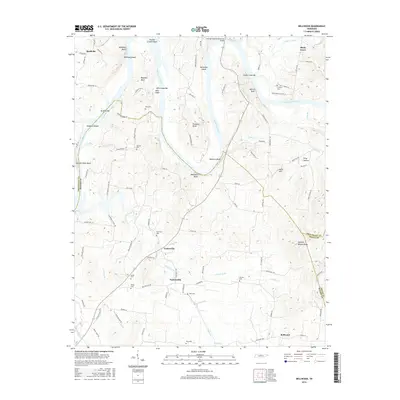
2016 Map of Bellwood
USGS Topo · Published 2016About this map
The Cumberland River carves a winding path through this region, creating a landscape defined by dramatic bluffs and fertile bends. Strategic crossings and river features like Whitleys Bluff, Belchers Bluff, and Goose Creek Bar underscore the waterway's role in the local geography. The map reveals a network of small agricultural communities including Centerville, Taylorsville, and Bellwood, situated near the convergence of Wilson and Smith counties. Local history is deeply etched into the land through numerous family burial sites, such as Speck Cem, Jackson Cem, and Tomlinson Cem. The southern portion of the sheet is dominated by the drainage of Cedar Creek, while the modern Coleman-Winston Memorial Bridge provides a primary transit link across the river, connecting the northern bluffs to the valley settlements below.
Find a feature on this map
109 named features on this map. Tap any name to fly to it.
Don’t see what you’re looking for? This feature index may not catch every label — zoom into the map to look around manually.
Map Details
Editions of this 2016 Bellwood Map
This is the sole edition of this map. No revisions or reprints were ever made.
Other maps of this area

1942 · Statesville
USGS Topo · 1:100,000

1942 · Gallatin
USGS Topo · 1:100,000

1942 · Lebanon
USGS Topo · 1:100,000

1951 · Lebanon
USGS Topo · 1:24,000

1955 · Bethpage
USGS Topo · 1:24,000

1955 · Hunters Point
USGS Topo · 1:24,000

1956 · Nashville
USGS Topo · 1:250,000

1958 · New Middleton
USGS Topo · 1:24,000

1958 · Bellwood
USGS Topo · 1:24,000

1958 · Dixon Springs
USGS Topo · 1:24,000