
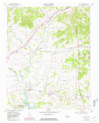
1955 Map of Bethpage
USGS Topo · Published 1956About this map
Bledsoe Creek carves a winding path through this mid-century landscape, serving as a primary drainage corridor for the surrounding hills of Sumner and Trousdale counties. The rural character of the region is defined by a dense network of country schools and churches, such as Durham Chapel Sch and Old Union Ch, which anchored these upland communities before modernization consolidated local districts. The Louisville and Nashville railroad runs through the heart of the area, connecting settlements like Bethpage and Hartsville Junction, while the southern reaches of the map show the impact of regional water management at the edge of the Old Hickory Reservoir. This survey captures the transition from traditional agrarian patterns to a landscape altered by infrastructure, visible in the Pipe Line corridors and the established community center at Castalian Springs.
Find a feature on this map
35 named features on this map. Tap any name to fly to it.
Don’t see what you’re looking for? This feature index may not catch every label — zoom into the map to look around manually.
Map Details
Editions of this 1955 Bethpage Map
2 editions found
Other maps of this area

1931 · Lafayette
USGS Topo · 1:62,500

1931 · Adolphus
USGS Topo · 1:62,500

1942 · Gallatin
USGS Topo · 1:100,000

1955 · Laguardo
USGS Topo · 1:24,000

1955 · Hunters Point
USGS Topo · 1:24,000

1955 · Gallatin
USGS Topo · 1:24,000

1956 · Nashville
USGS Topo · 1:250,000

1958 · Westmoreland
USGS Topo · 1:24,000
1958 · Fountain Head
USGS Topo · 1:24,000

1958 · Bellwood
USGS Topo · 1:24,000