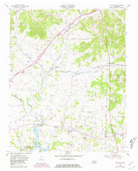
1955 Map of Bethpage
USGS Topo · Published 1981About this map
The Louisville and Nashville Railroad cuts a diagonal path through this Sumner County landscape, linking rural crossroads like Bethpage and Rogana to the wider region. The terrain is defined by the winding course of Bledsoe Creek, which feeds into Hickory Lake near the southern edge of the survey. This water network was central to the area's development, as evidenced by the concentration of early institutional landmarks.
Find a feature on this map
33 named features on this map. Tap any name to fly to it.
Don’t see what you’re looking for? This feature index may not catch every label — zoom into the map to look around manually.
Map Details
Editions of this 1955 Bethpage Map
2 editions found
Other maps of this area

1931 · Lafayette
USGS Topo · 1:62,500

1931 · Adolphus
USGS Topo · 1:62,500

1942 · Gallatin
USGS Topo · 1:100,000

1955 · Bethpage
USGS Topo · 1:24,000

1955 · Laguardo
USGS Topo · 1:24,000

1955 · Hunters Point
USGS Topo · 1:24,000

1955 · Gallatin
USGS Topo · 1:24,000

1956 · Nashville
USGS Topo · 1:250,000

1958 · Westmoreland
USGS Topo · 1:24,000
1958 · Fountain Head
USGS Topo · 1:24,000