Old Maps of Sumner County, Tennessee
Explore 146 old maps of Sumner County, spanning from 1903 to today. These high-resolution historic maps reveal how streets, neighborhoods, landmarks, and natural features evolved over time — perfect for genealogy, metal detecting, research, and local history exploration.
What you can do with these maps:
- See how Sumner County changed over time: Compare historical maps to modern-day views to trace roads, homesites, rail lines & more.
- View detailed metadata: Each map includes creators, publishers, year, scale, and archive source.
- Overlay maps with satellite & LiDAR: Visualize the past alongside modern tools to explore terrain & human change.
- Trusted historical sources: Maps sourced from the USGS, Library of Congress, and other archives.
- Access maps your way: View online, download high-res files, or order prints for personal or research use.
Start exploring old maps of Sumner County to uncover forgotten places, hidden landmarks, and the deep history beneath your feet.
Sumner County, TN maps
(146)- 1903 Map of Nashville
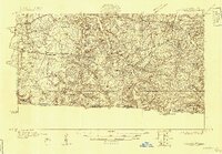
 1903 Nashville1903 Print · USGSTennessee's capital region is captured at the dawn of the 1900s, when iron pikes and river locks dominated local commerce. Trace ancestral routes along Stewarts Ferry Pike, find rural landmarks like Curry Mill, or locate historical sites like The Hermitage.4 unique versions available
 - 1928 Map of Adolphus
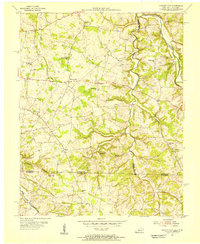
 1928 Adolphus1928 Print · USGSThe Kentucky-Tennessee state line was a landscape of small schools and river crossings in the late twenties. Genealogists can locate family landmarks like Allen Cem, Reeders Sch, and the numerous crossings along Trammel Creek including Old Mill Ford.
 - 1931 Map of Lafayette
 1931 Lafayette1931 Print · USGSThe Kentucky and Tennessee borderlands in the late twenties were a network of tight-knit rural communities connected by winding river hollows. Genealogists and local historians can trace family roots through numerous small landmarks like Austin Sch, Mt Zion Ch, and the settlement of Holland.2 unique versions available
 - 1931 Map of Adolphus
 1931 Adolphus1931 Print · USGSThe Kentucky-Tennessee state line was a landscape of river fords and country schoolhouses during the late Prohibition era. Genealogists can trace family footprints through dozens of local landmarks like Old Mill Ford, McKendree Chapel, and Pinkle Cem.2 unique versions available
 - 1931 Map of Ridgetop, 1957 Print
 1931 Ridgetop1957 Print · USGSUpper Middle Tennessee in the early thirties reveals a landscape of ridge-top towns and deep hollows. Genealogists can trace family footprints through dozens of rural landmarks like St Michaels Ch, Gordons Store, and the old Ridgetop Sta.2 unique versions available
 - 1932 Map of Hermitage
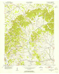
 1932 Hermitage1932 Print · USGSGreater Nashville and its rural eastern reaches come alive in the early 1930s, documenting the river-bend communities and pike roads before modern sprawl. Genealogists can trace family roots through dozens of local landmarks like Woodbine P O, Clover Bottom, and the Andrew Jackson Sch.3 unique versions available
 - 1935 Map of Ridgetop
 1935 Ridgetop1935 Print · USGSNorthern Tennessee's ridge country is captured here between the mid-twenties and early thirties, showing a landscape tied to the Louisville and Nashville railroad. Genealogists can trace family roots through numerous local landmarks like Bethlehem Sch, Gordons Store, and St Michaels Ch.2 unique versions available
 - 1942 Map of Gallatin
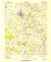
 1942 Gallatin1942 Print · USGSThe Tennessee-Kentucky borderlands were a crossroads of river and rail during the early war years. Genealogists and historians can trace family roots through dozens of named settlements like Bethpage, Prices Mill, and Mitchellville, or locate historic river crossings such as Kirkpatricks Ferry.
 - 1942 Map of Lebanon, 1944 Print
 1942 Lebanon1944 Print · USGSMiddle Tennessee at the start of the war years reveals a landscape of historic homesteads and burgeoning military infrastructure. Genealogists and historians can trace family locations near The Hermitage, follow the Tennessee Central rail lines, or locate the newly established Smyrna Air Base.
 - 1951 Map of Franklin, 1952 Print
 1951 Franklin1952 Print · USGSThe Kentucky-Tennessee borderlands in the early fifties come to life on this detailed map of the Franklin area. Genealogists and historians can trace the Louisville and Nashville rail line and locate rural landmarks like Peden Mill and Union Chapel.2 unique versions available
 - 1952 Map of Goodlettsville, 1953 Print
 1952 Goodlettsville1953 Print · USGSNorth of Nashville in the early fifties, the landscape around the Cumberland River reflects a mix of industrial river towns and rural crossroads. Genealogists can trace family footprints through numerous local landmarks like Lumsley Church, Old Center, and the sprawling grounds of Madison College.
 - 1952 Map of Hendersonville, 1953 Print
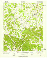
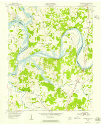
 1952 Hendersonville1953 Print · USGSSumner County is captured here in the early fifties, before the rapid suburban expansion of the Nashville region. Genealogists can locate family landmarks such as Shackle Island, Stark Knob Ch, and the winding Walton Ferry Road along the river.
 - 1952 Map of Hermitage, 1954 Print
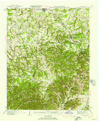
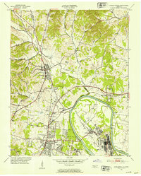
 1952 Hermitage1954 Print · USGSDavidson and Wilson counties are captured in the early fifties, showing the rural landscapes around the Cumberland River before significant suburban growth. Trace family roots at The Hermitage, Bakers Grove Ch, and the Confederate Memorial Cem.
 - 1953 Map of Cottontown, 1955 Print
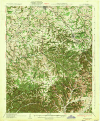
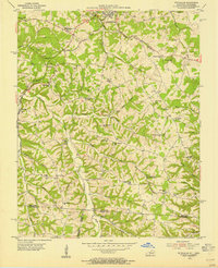
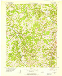
 1953 Cottontown1955 Print · USGSIn the early 1950s, Sumner County remained a patchwork of ridge-top farms and creek-bottom settlements. Genealogists and historians can trace family roots through dozens of local landmarks like Johnsons Crossroads, Little Bethel Church, and the Old Indian Cem.3 unique versions available
 - 1953 Map of Orlinda, 1955 Print
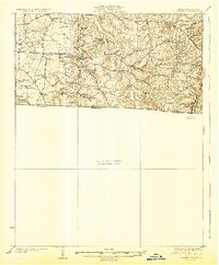
 1953 Orlinda1955 Print · USGSUpper Middle Tennessee near the Kentucky border comes to life in this mid-century survey of rural Robertson and Sumner counties. Genealogists can trace family names through sites like Kilgore Station, Jamestown School, and dozens of family plots like Traughber Cem.3 unique versions available
 - 1954 Map of White House, 1955 Print
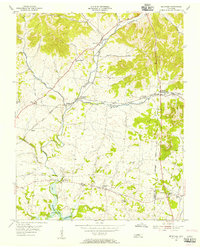
 1954 White House1955 Print · USGSThe Tennessee borderlands of Robertson and Sumner counties are captured here in the mid-1950s. Family researchers can trace dozens of homesteads and burial grounds like the Strickland Cem, alongside landmarks such as Indian Cave and White House.4 unique versions available
 - 1954 Map of Petroleum, 1955 Print
 1954 Petroleum1955 Print · USGSAllen County, Kentucky, supported a thriving rural oil economy in the mid-1950s centered around the namesake town of Petroleum. Researchers can locate numerous active Oil Wells and trace family heritage through sites like White Plains Sch and Mt Pleasant Ch.4 unique versions available
 - 1954 Map of Hickory Flat, 1956 Print
 1954 Hickory Flat1956 Print · USGSThe Kentucky and Tennessee borderlands in the mid-1950s show a dense network of rural life organized around the Drakes Creek forks. Genealogists can trace family footprints through numerous small landmarks like Bethany Cem, Round Pond Sch, and the community of New Roe.
 - 1954 Map of Adolphus, 1956 Print
 1954 Adolphus1956 Print · USGSThe Kentucky-Tennessee borderlands in the mid-fifties were defined by tight-knit rural communities and the rail traffic of the Louisville and Nashville. Genealogists can trace family footprints through numerous local landmarks like Walkers Chapel School, Roberts Tabernacle, and Adolphus.2 unique versions available
 - 1955 Map of Bethpage, 1956 Print
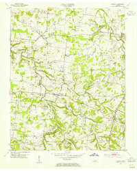
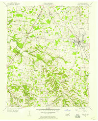
 1955 Bethpage1956 Print · USGSMid-century Sumner County, Tennessee, shows a landscape of established rail hubs and quiet country crossroads. Genealogists and local historians can trace the foundations of these communities through the locations of the Durham Chapel Sch, Shiloh Ch, and the historic Castalian Springs.2 unique versions available
 - 1955 Map of Laguardo, 1956 Print
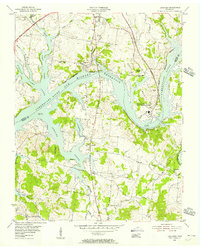 1955 Laguardo1956 Print · USGSThe Cumberland River valley transitioned into a modern utility corridor in the mid-fifties as the reservoir waters rose. Genealogists and historians can trace local landmarks like the Odoms Bend Sch, Franklin Chapel, and the Drive-in Theatre near Laguardo.5 unique versions available
 - 1955 Map of Hunters Point, 1956 Print
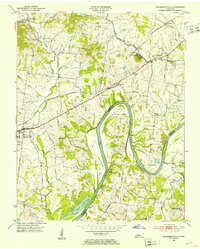
 1955 Hunters Point1956 Print · USGSNorth of Lebanon in the mid-1950s, the rising waters of the Old Hickory Reservoir began to transform these historic river bends. Researchers can locate family landmarks like Ebenezer Cem and trace the paths of Coles Ferry Road and Cedar Pike.4 unique versions available
 - 1955 Map of Gallatin, 1956 Print
 1955 Gallatin1956 Print · USGSGallatin and the surrounding Sumner County countryside are captured here in the mid-fifties as the local landscape balanced traditional farming with new infrastructure. Researchers can trace family-named hollows and sites like Bushs Chapel Sch, South Tunnel, and Salem Ch.5 unique versions available
 - 1956 Map of Portland, 1957 Print
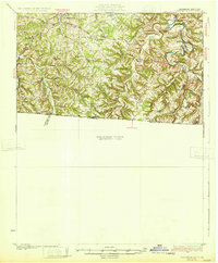
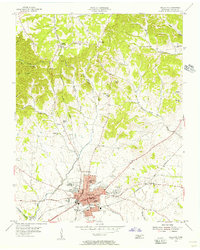
 1956 Portland1957 Print · USGSSumner County during the mid-fifties shows a landscape of small farming hamlets and steam-era rail infrastructure. Researchers can trace family roots at Byram Chapel, locate the site of Oakmont Sch, and follow the Louisville and Nashville line through Portland.4 unique versions available
 - 1956 Map of Nashville, 1971 Print
 1956 Nashville1971 Print · USGSThe Tennessee-Kentucky borderlands come into focus in the mid-1960s as major reservoir projects transformed the Cumberland and Tennessee river valleys. Researchers can trace the rail networks of the Louisville and Nashville and visit sites like Fort Campbell and Fort Donelson National Military Park.2 unique versions available
Showing maps 1-25 of 146
Top cities of Sumner County
- Hendersonville historical maps
- Gallatin historical maps
- Portland historical maps
- Millersville historical maps
- Westmoreland historical maps
- Mitchellville historical maps
Frequently asked questions
- What are the different types of historical maps available for Sumner County?
- What is the oldest map of Sumner County?
- Where can I purchase historical maps of Sumner County for my home or office?
- Where can I download high-res historical maps of Sumner County?
- Are there historical topographic maps available for Sumner County?
- Is there historical aerial imagery available for Sumner County?
- Where are historical maps of Sumner County sourced from?