2020s Maps of Sumner County, Tennessee
Explore 20 historic maps of Sumner County from the 2020s. These maps offer a rare glimpse into what life looked like during the 2020s — showing old roads, neighborhoods, homes, and landmarks that have changed or disappeared over time.
Whether you're researching your family's past, planning a metal detecting trip, or studying how Sumner County's landscape evolved across the 2020s, these high-resolution maps are a powerful tool for exploring the history of this region.
- Focus on a specific era: All maps on this page are from the 2020s, giving you a focused view of this time period.
- See what’s changed: Compare century-old streets, trails, and buildings to today's modern landscape using overlays and satellite layers.
- Research with precision: Use these maps for genealogy, historical research, land use analysis, or educational projects.
- View, download, or print: Maps are fully viewable online in high resolution, and can be downloaded or printed for your own records.
Start exploring Sumner County's history through authentic maps from the 2020s. This is your window into the past.
Sumner County, TN maps
(20)- 2022 Map of Hunters Point, 2022 Print
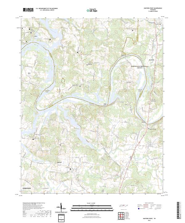 2022 Hunters Point2022 Print · USGSThe winding Cumberland River valley near Lebanon and Oakland is captured here as it appeared in 2022. Researchers can locate many family-named landmarks and cemeteries, including Austin-Hollerman Family Cem, Indian Ladder Bluff, and Cairo.
 - 2022 Map of White House, 2022 Print
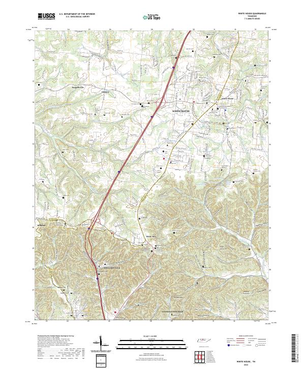 2022 White House2022 Print · USGSCovers Sumner County, including Nashville, Goodlettsville, and other nearby areas
 - 2022 Map of Fountain Head, 2022 Print
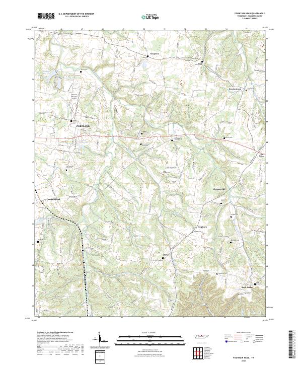 2022 Fountain Head2022 Print · USGSSumner County, Tennessee, is mapped here in the early twenty-first century, showing the growth of Portland and its surrounding rural hamlets. Researchers can trace dozens of family burial grounds and historic communities, from Sulphura and Sengtown to the Brizendine Graveyard.
 - 2022 Map of Cottontown, 2022 Print
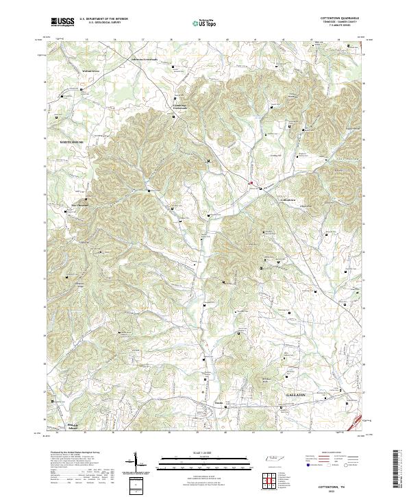 2022 Cottontown2022 Print · USGSThe rural uplands of Sumner County are captured here during a period of steady growth north of the Cumberland River. Researchers can trace ancestral lands and family burial plots through sites like the Old Indian Cem, Two Chestnut, and Strother - Mitchell Cem.
 - 2022 Map of Orlinda, 2022 Print
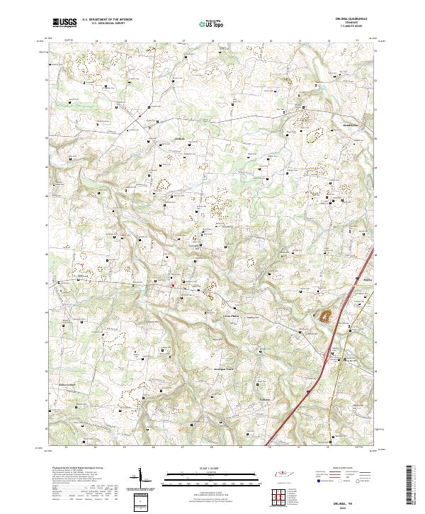 2022 Orlinda2022 Print · USGSUpper middle Tennessee farmland along the Kentucky border remains anchored by its historic cemeteries and small crossroads communities. Genealogists can trace family lines across dozens of rural burial sites like Traughber Cem and Long Payne Cem near Orlinda.
 - 2022 Map of Westmoreland, 2022 Print
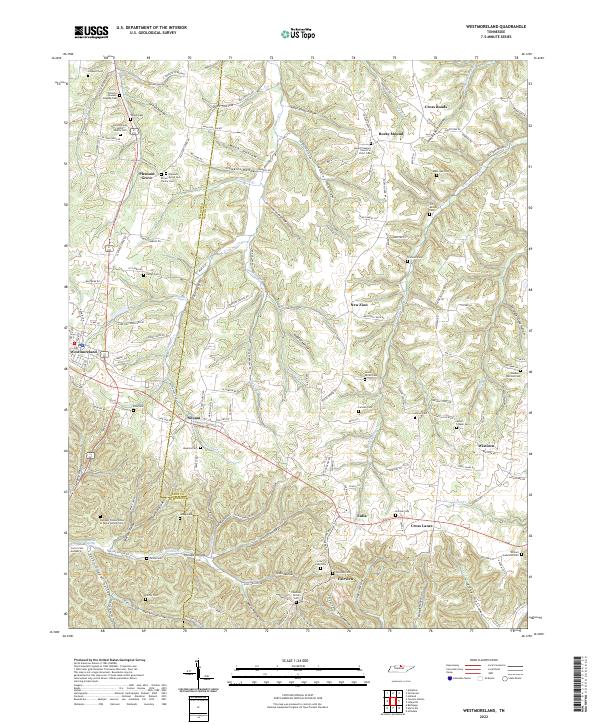 2022 Westmoreland2022 Print · USGSThe hills of the Tennessee border country come alive in this map of the Sumner and Macon county line. Genealogists can trace deep roots through family-named sites like the James Brown Senior Family Cem and G T Dalton Cem or explore the hollows around Westmoreland.
 - 2022 Map of Gallatin, 2022 Print
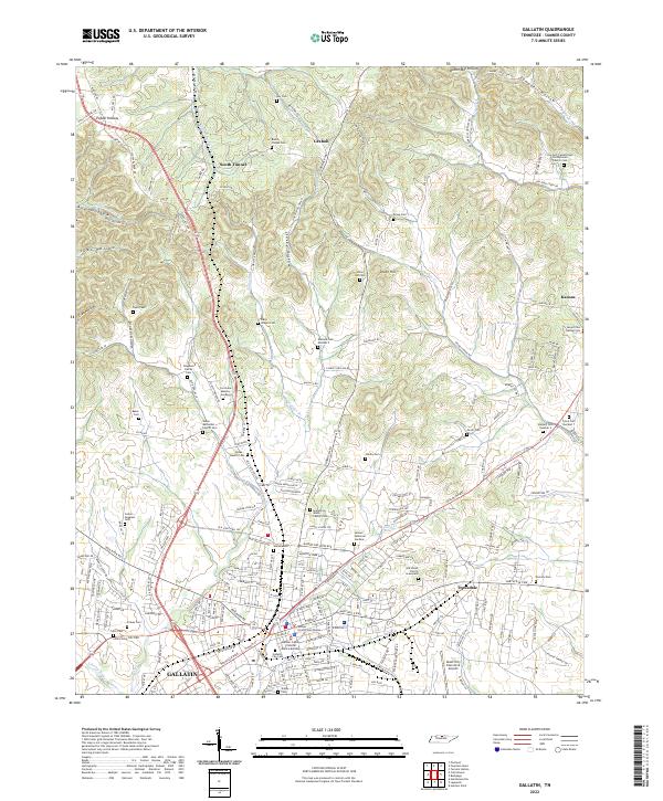 2022 Gallatin2022 Print · USGSGallatin and the surrounding Sumner County countryside are captured here in a period of modern expansion alongside deeply rooted local history. Genealogists can trace family names across dozens of sites like the Salem Methodist Church Cem, Key Cem, or the Old Shiloh Church Graveyard.
 - 2022 Map of Turners Station, 2022 Print
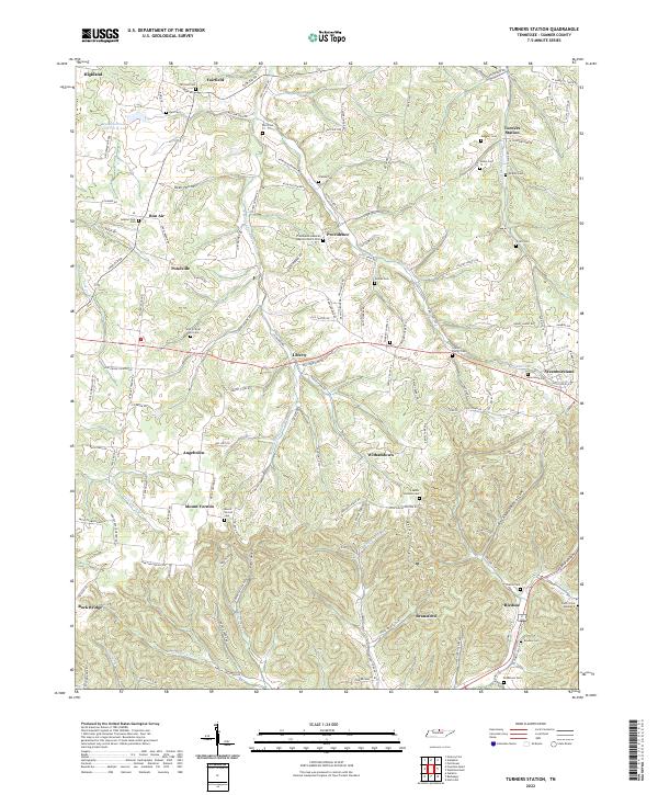 2022 Turners Station2022 Print · USGSIn the hills of Sumner County, Tennessee, this recent mapping reveals an intricate landscape of family-named hollows and historic cemeteries. Genealogists can trace family footprints at the Who So Ever Will Cem, Turners Station, or the Providence General Baptist Church Cem.
 - 2022 Map of Hendersonville, 2022 Print
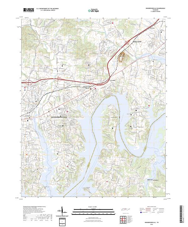 2022 Hendersonville2022 Print · USGSThe Sumner County lakefront south of Gallatin is shown here in the early twenty-first century as suburban growth meets the historic Cumberland River. Trace family roots at the Stark Family Homestead Cem or explore the landscape around Pilot Knob and Saundersville.
 - 2022 Map of Hartsville, 2022 Print
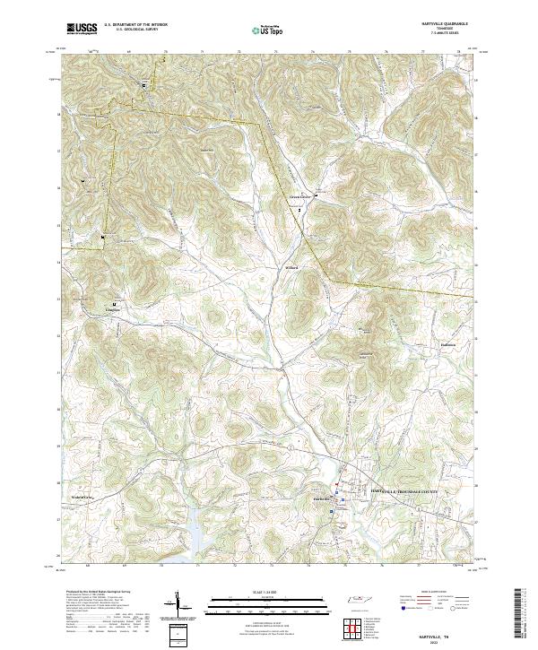 2022 Hartsville2022 Print · USGSHartsville and the surrounding hollows of Trousdale County are shown here in the early twenty-first century, anchored by the Trousdale County Courthouse. Genealogists and local historians can locate numerous family burial grounds like Willow Grove Cem and Templow Cem tucked away near Little Goose Creek.
 - 2022 Map of Bethpage, 2022 Print
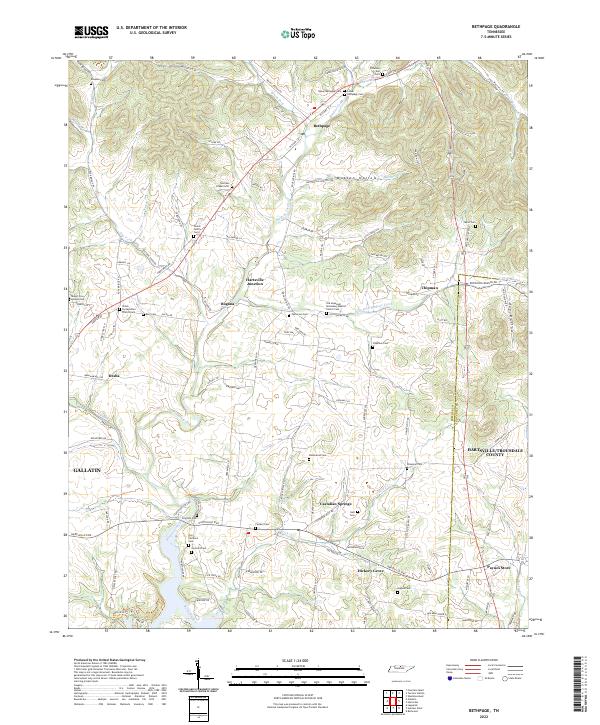 2022 Bethpage2022 Print · USGSSumner and Trousdale counties come into focus in the early 2020s, showcasing a landscape defined by creek valleys and long-standing family settlements. Researchers can trace dozens of family burial sites like Durham Chapel Cem and Taylor Cem, or locate landmarks such as Castalian Springs and Paynes Store.
 - 2022 Map of Goodlettsville, 2022 Print
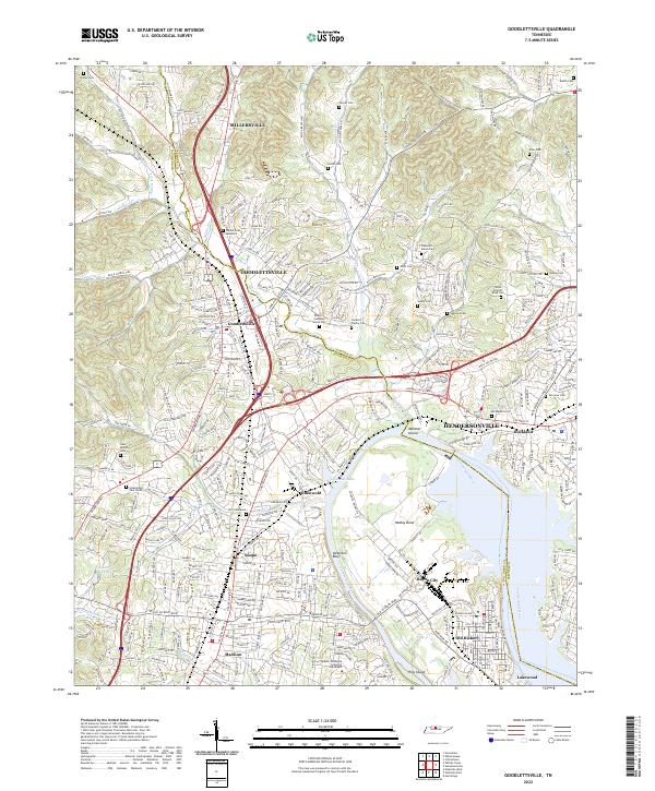 2022 Goodlettsville2022 Print · USGSThe northern Nashville suburbs and the Cumberland River valley appear in high detail during this recent period of growth. Researchers can trace numerous family burial sites and historical landmarks like the Bowen Campbell House Cem, Lutons Cem, and the Middle Tennessee School of Anesthesia.
 - 2022 Map of Portland, 2022 Print
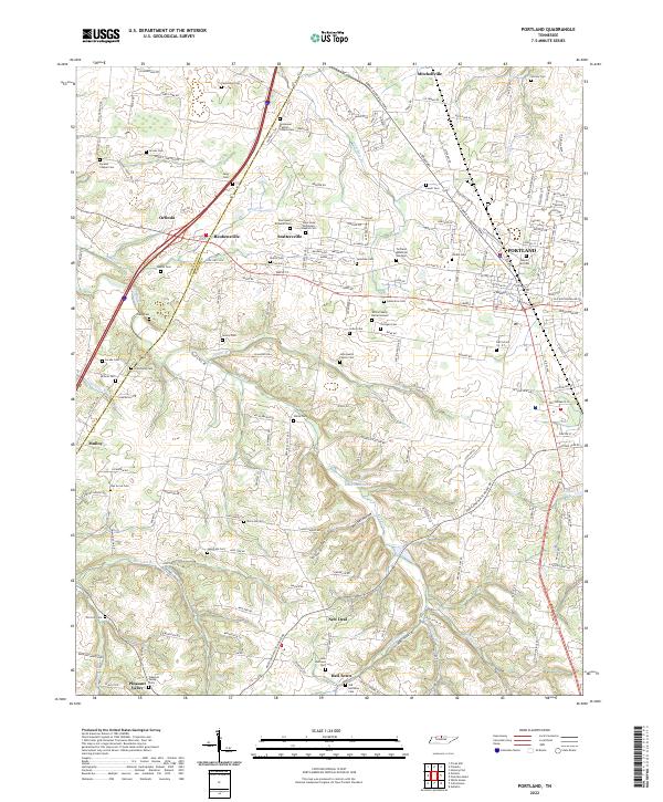 2022 Portland2022 Print · USGSNorthern Tennessee at the turn of the decade shows a landscape of growing towns and deep-rooted family history. Genealogists can trace local lineages through dozens of sites like the White Family Burial Ground, John Austin Family Cem, and Maple Hill Cem.
 - 2022 Map of Greenbrier, 2022 Print
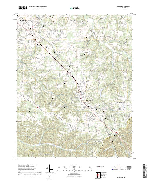 2022 Greenbrier2022 Print · USGSThe southern Robertson County plateau comes to life in this survey of the communities between Springfield and Ridgetop. Genealogists and historians can trace dozens of family-named landmarks including Wartrace Cem, Hygeia Springs, and Lutons Cem.
 - 2022 Map of Hermitage, 2022 Print
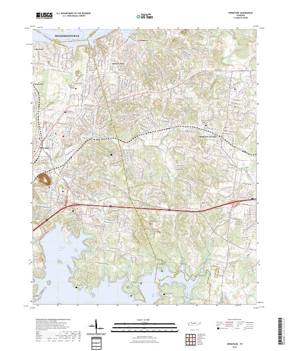 2022 Hermitage2022 Print · USGSThe eastern Nashville suburbs near Hermitage and Mount Juliet come alive in this detailed recent survey. Genealogists can trace family heritage through numerous burial sites like John G Gleaves Cem, Cowgill Cem, and Jenkins Cem tucked along the Stoners Cr watershed.
 - 2022 Map of Laguardo, 2022 Print
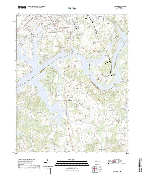 2022 Laguardo2022 Print · USGSSumner and Wilson Counties are captured here as modern infrastructure meets the historic river bends of the northern Tennessee landscape. Researchers can trace numerous family burial grounds including Vinson Family Cem, Newton Cem, and Harper Cem near the banks of the Cumberland River.
 - 2022 Map of Franklin, 2022 Print
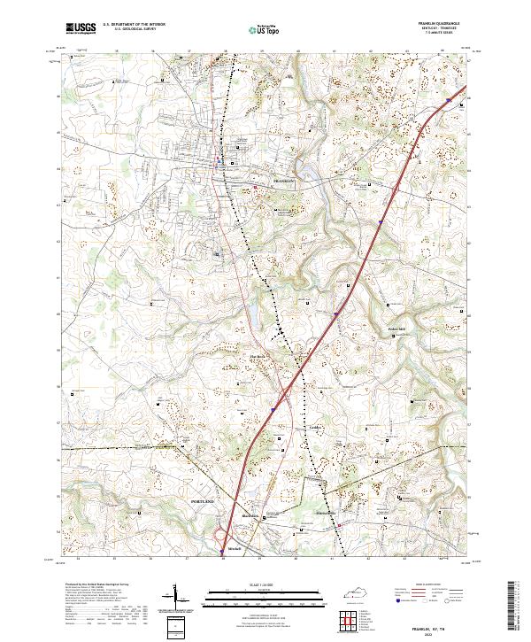 2022 Franklin2022 Print · USGSSouthern Kentucky and northern Tennessee meet along this corridor during a period of modern growth and deep-rooted rural history. Genealogists can trace family names at Peden Mill, the Mitchell Family Cem, and Drakes Creek Baptist Church Cem.
 - 2022 Map of Adolphus, 2022 Print
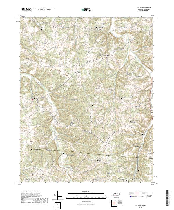 2022 Adolphus2022 Print · USGSThe Kentucky-Tennessee borderlands appear here in the early twenty-first century, centered on the community of Adolphus. Genealogists and historians can trace family locations through numerous sites like Lamb Family Cem, Walkers Chapel Cem, and Sugar Grove Airport.
 - 2022 Map of Petroleum, 2022 Print
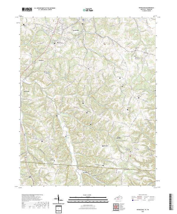 2022 Petroleum2022 Print · USGSAllen County at the Kentucky-Tennessee border reveals a landscape of deep hollows and high ridges centered on the rail lines and rural hamlets. Researchers can trace numerous country burial sites and churches, from Barefoot and Petroleum to the Mount Pleasant Methodist Church Cem.
 - 2022 Map of Hickory Flat, 2022 Print
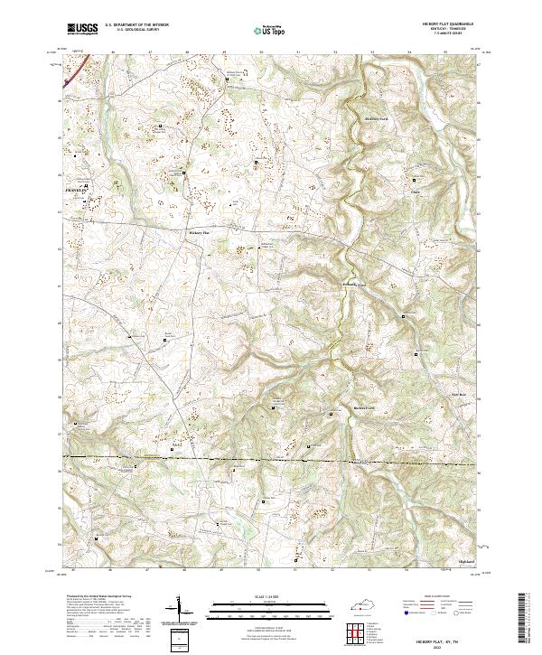 2022 Hickory Flat2022 Print · USGSThe Kentucky and Tennessee borderlands come into focus in this recent study of rural settlements. Genealogists can trace family roots through numerous sites like Old Loving Chapel Cem and historic crossings such as Bornes Ford.
End of results
Showing maps 1-20 of 20
Top cities of Sumner County
- Hendersonville historical maps
- Gallatin historical maps
- Portland historical maps
- Millersville historical maps
- Westmoreland historical maps
- Mitchellville historical maps
Frequently asked questions
- What are the different types of historical maps available for Sumner County?
- What is the oldest map of Sumner County?
- Where can I purchase historical maps of Sumner County for my home or office?
- Where can I download high-res historical maps of Sumner County?
- Are there historical topographic maps available for Sumner County?
- Is there historical aerial imagery available for Sumner County?
- Where are historical maps of Sumner County sourced from?