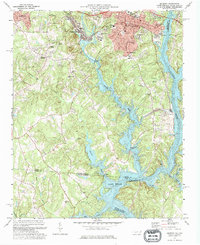
2022 Map of Belmont
USGS Topo · Published 2022About this map
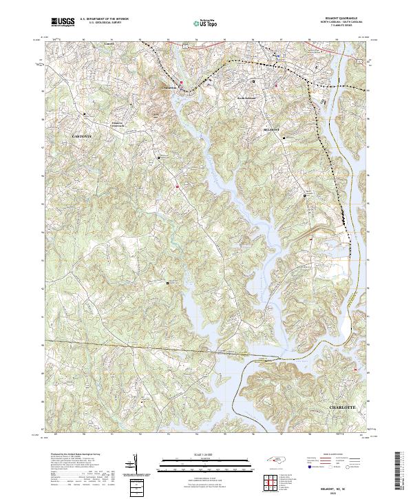
The South Fork Catawba River carves a deep path through this landscape, marking the historic industrial and natural boundary between Belmont and Cramerton. This modern survey illustrates the complex intersection of the North Carolina and South Carolina state line, where Lake Wylie and J W Stowe Lake dominate the southeastern topography. The map reveals a dense network of suburban growth layered over an older rural foundation, evidenced by numerous family and community burial grounds such as Greenwood Cem, Smith Cem, and the Mill Creek Cem.
Find a feature on this map
35 named features on this map. Tap any name to fly to it.
Don’t see what you’re looking for? This feature index may not catch every label — zoom into the map to look around manually.
Map Details
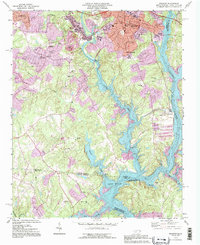
Editions of this 2022 Belmont Map
This is the sole edition of this map. No revisions or reprints were ever made.
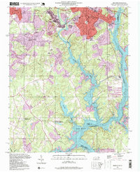
Historical Maps of Charlotte Through Time
5 maps found