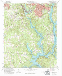
1973 Map of Belmont
USGS Topo · Published 1976About this map
The South Fork Catawba River flows through a landscape defined by textile manufacturing and institutional growth in the early 1970s. This industrial corridor is anchored by Belmont and Cramerton, where the Southern railroad and infrastructure like the State Textile Sch and a large Powerplant reflect the region's economic drivers. The transition from industrial centers to rural communities is marked by several church-centered settlements, including Elmores Crossroads and New Hope, while Sacred Heart College stands as a prominent landmark in the north.
Find a feature on this map
49 named features on this map. Tap any name to fly to it.
Don’t see what you’re looking for? This feature index may not catch every label — zoom into the map to look around manually.
Map Details
Editions of this 1973 Belmont Map
This is the sole edition of this map. No revisions or reprints were ever made.
Other maps of this area

1905 · Charlotte
USGS Topo · 1:48,000

1907 · Charlotte
USGS Topo · 1:62,500

1914 · Gastonia
USGS Topo · 1:48,000

1916 · Gastonia
USGS Topo · 1:62,500

1941 · Charlotte
USGS Topo · 1:125,000

1942 · Charlotte
USGS Topo · 1:125,000

1947 · Clover
USGS Topo · 1:62,500

1948 · Paw Creek
USGS Topo · 1:24,000

1948 · Charlotte West
USGS Topo · 1:24,000

1949 · Clover
USGS Topo · 1:62,500