
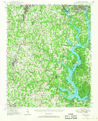
1947 Map of Clover
USGS Topo · Published 1956About this map
Lake Catawba and the South Fork Catawba River dominate this 1940s landscape, illustrating the critical intersection of water power and regional development. The map details the complex shoreline created by the Catawba Dam, where recreational and institutional outposts like Camp Steere and the Charlotte Observatory overlook the water. To the north, the industrial character of Belmont and Cramerton is evident, while the rural South Carolina hinterlands show a dense network of country schools and churches, including the uniquely named Shiny Eye Sch and Weeping Mary Ch.
Find a feature on this map
93 named features on this map. Tap any name to fly to it.
Don’t see what you’re looking for? This feature index may not catch every label — zoom into the map to look around manually.
Map Details
Editions of this 1947 Clover Map
2 editions found
Other maps of this area

1905 · Charlotte
USGS Topo · 1:48,000

1906 · Kings Mountain
USGS Topo · 1:62,500

1907 · Sharon
USGS Topo · 1:62,500

1907 · Charlotte
USGS Topo · 1:62,500

1908 · Kings Mountain
USGS Topo · 1:62,500

1909 · Lincolnton
USGS Topo · 1:62,500

1911 · Lincolnton
USGS Topo · 1:62,500

1914 · Gastonia
USGS Topo · 1:48,000

1916 · Gastonia
USGS Topo · 1:62,500

1941 · Charlotte
USGS Topo · 1:125,000