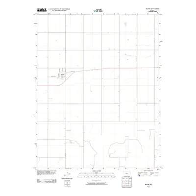
2009 Map of Belpre
USGS Topo · Published 2009About this map
Belpre occupies a grid of residential and commercial streets in the Edwards County plains, serving as a localized hub for the surrounding agricultural landscape. The town site is defined by a primary corridor along Hudson Ave and north-south routes including Main St and Dudley St. This 2009 survey illustrates the organized land-division pattern typical of the Kansas prairie, where section lines dictate the placement of county roads such as Co Rd 53 and SW 150th Ave. North of the settlement, the drainage of Wild Horse Creek meanders eastward across the open fields. The infrastructure of the era is anchored by Old Hwy 50, which angles through the northern edge of the town, reflecting the historical transportation network that facilitated the movement of grain and goods through this rural interior.
Find a feature on this map
12 named features on this map. Tap any name to fly to it.
Don’t see what you’re looking for? This feature index may not catch every label — zoom into the map to look around manually.
Map Details
Editions of this 2009 Belpre Map
This is the sole edition of this map. No revisions or reprints were ever made.
Other maps of this area

1889 · Larned
USGS Topo · 1:125,000

1889 · Kinsley
USGS Topo · 1:125,000

1891 · Great Bend
USGS Topo · 1:125,000

1891 · Larned
USGS Topo · 1:125,000

1892 · Kinsley
USGS Topo · 1:125,000

1892 · Pratt
USGS Topo · 1:125,000

1893 · Great Bend
USGS Topo · 1:125,000

1894 · Kinsley
USGS Topo · 1:125,000

1894 · Pratt
USGS Topo · 1:125,000

1955 · Great Bend
USGS Topo · 1:250,000