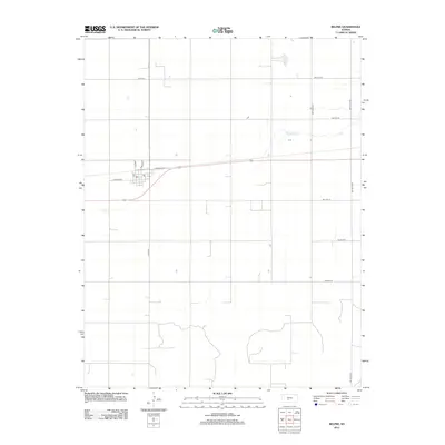
2012 Map of Belpre
USGS Topo · Published 2012About this map
Belpre stands as the primary hub of this Edwards County landscape, organized around a traditional grid of streets including Main St, Dudley St, and Hudson Ave. The town center is marked by a local Po, serving the surrounding agricultural community. The terrain is characterized by the wide, open spaces of the Kansas plains, partitioned by an orderly network of section-line roads like SW 150th Ave and NW 20th St. Water is a scarce but defining element, notably represented by the winding path of Wild Horse Cr as it traverses the eastern portion of the quadrangle. Transportation is anchored by major corridors such as Co Hwy-14 and Campbell Ave, which connect this rural settlement to the broader region during the early twenty-first century.
Find a feature on this map
18 named features on this map. Tap any name to fly to it.
Don’t see what you’re looking for? This feature index may not catch every label — zoom into the map to look around manually.
Map Details
Editions of this 2012 Belpre Map
This is the sole edition of this map. No revisions or reprints were ever made.
Other maps of this area

1889 · Larned
USGS Topo · 1:125,000

1889 · Kinsley
USGS Topo · 1:125,000

1891 · Great Bend
USGS Topo · 1:125,000

1891 · Larned
USGS Topo · 1:125,000

1892 · Kinsley
USGS Topo · 1:125,000

1892 · Pratt
USGS Topo · 1:125,000

1893 · Great Bend
USGS Topo · 1:125,000

1894 · Kinsley
USGS Topo · 1:125,000

1894 · Pratt
USGS Topo · 1:125,000

1955 · Great Bend
USGS Topo · 1:250,000