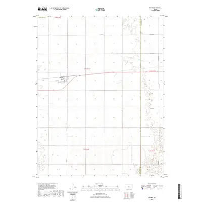
2018 Map of Belpre
USGS Topo · Published 2018About this map
Belpre serves as the primary hub of this Edwards County landscape, positioned where the local grid of Hudson Ave and Tanner St meets the transit corridor of Old Hwy 50. The town is the central focal point for the surrounding agricultural sections, supported by a local Po and a network of section-line roads like Co Rd 53. The terrain is defined by its subtle drainage patterns, most notably the winding path of Wild Horse Cr which cuts through the northeastern reaches of the quadrangle. This 2018 survey captures the precise organization of the High Plains, showing how the rural road system, including Co Rd 14, maintains a rigid square-mile structure across the prairie landscape. The interplay between these engineered transport routes and the natural course of the creek highlights the historical development of the region's ranching and farming infrastructure.
Find a feature on this map
20 named features on this map. Tap any name to fly to it.
Don’t see what you’re looking for? This feature index may not catch every label — zoom into the map to look around manually.
Map Details
Editions of this 2018 Belpre Map
This is the sole edition of this map. No revisions or reprints were ever made.
Other maps of this area

1889 · Larned
USGS Topo · 1:125,000

1889 · Kinsley
USGS Topo · 1:125,000

1891 · Great Bend
USGS Topo · 1:125,000

1891 · Larned
USGS Topo · 1:125,000

1892 · Kinsley
USGS Topo · 1:125,000

1892 · Pratt
USGS Topo · 1:125,000

1893 · Great Bend
USGS Topo · 1:125,000

1894 · Kinsley
USGS Topo · 1:125,000

1894 · Pratt
USGS Topo · 1:125,000

1955 · Great Bend
USGS Topo · 1:250,000