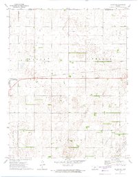
1972 Map of Belpre NW
USGS Topo · Published 1974About this map
The boundary between Pawnee Co and Edwards Co divides this rural Kansas landscape, where the agriculture-driven economy of the early 1970s is clearly visible. The Atchison Topeka and Santa Fe railroad corridor serves as the primary East-West transit spine, connecting the townships of Wayne and Belpre. This survey captures a specific era of infrastructure, noting numerous oil or water wells scattered across the farm plots and a network of pipelines that cut across sections of Franklin and Lincoln. Local history is anchored by the Wayne Cem, while modern utility is represented by the Cross Landing Strip and Sewage Disp Ponds. The map provides a detailed view of section lines and field boundaries as they existed before further consolidation in the late 20th century.
Find a feature on this map
14 named features on this map. Tap any name to fly to it.
Don’t see what you’re looking for? This feature index may not catch every label — zoom into the map to look around manually.
Map Details
Editions of this 1972 Belpre NW Map
This is the sole edition of this map. No revisions or reprints were ever made.
Other maps of this area

1889 · Larned
USGS Topo · 1:125,000

1889 · Kinsley
USGS Topo · 1:125,000

1891 · Larned
USGS Topo · 1:125,000

1892 · Kinsley
USGS Topo · 1:125,000

1894 · Kinsley
USGS Topo · 1:125,000

1955 · Great Bend
USGS Topo · 1:250,000

1955 · Pratt
USGS Topo · 1:250,000

1957 · Great Bend
USGS Topo · 1:250,000

1958 · Great Bend
USGS Topo · 1:250,000

1959 · Pratt
USGS Topo · 1:250,000