
1970 Map of Bemis
USGS Topo · Published 1972About this map
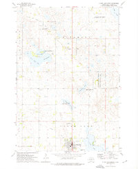
Bemis and the surrounding townships of Goodwin and Havana define this prairie landscape in Deuel County during the early 1970s. The map illustrates a settled agricultural region marked by a network of rural institutions, including the Bemis Ch and multiple community burial grounds such as Swedish Cem, Bemis Cem, and Evergreen Cem. A prominent Old Railroad Grade cuts through the terrain, tracing the path of former rail commerce that once linked these small Dakota outposts.
Find a feature on this map
18 named features on this map. Tap any name to fly to it.
Don’t see what you’re looking for? This feature index may not catch every label — zoom into the map to look around manually.
Map Details
Editions of this 1970 Bemis Map
This is the sole edition of this map. No revisions or reprints were ever made.
Other maps of this area

1953 · Watertown
USGS Topo · 1:250,000

1958 · Watertown
USGS Topo · 1:250,000

1969 · Dempster
USGS Topo · 1:24,000

1970 · Kranzburg SW
USGS Topo · 1:24,000

1970 · Kranzburg
USGS Topo · 1:24,000

1970 · Clear Lake South
USGS Topo · 1:24,000

1970 · Goodwin
USGS Topo · 1:24,000

1970 · Estelline NE
USGS Topo · 1:24,000

1973 · Tunerville
USGS Topo · 1:24,000
1973 · Clear Lake North
USGS Topo · 1:24,000