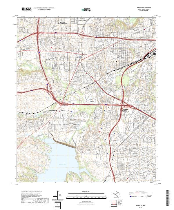
2022 Map of Benbrook
USGS Topo · Published 2022About this map
The Clear Fork Trinity River winds through this modern urban-suburban landscape, anchored by the significant waters of Benbrook Lake to the south. This area of Tarrant County reflects heavy 21st-century development, where the established community of Benbrook meets the western expansion of Fort Worth. The map details a dense network of major infrastructure, including the Union Pacific RR and the intersection of W Loop 820 S, which cuts through neighborhoods like Westland and Westover Hills.
Find a feature on this map
376 named features on this map. Tap any name to fly to it.
Don’t see what you’re looking for? This feature index may not catch every label — zoom into the map to look around manually.
Map Details
Editions of this 2022 Benbrook Map
This is the sole edition of this map. No revisions or reprints were ever made.
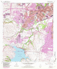
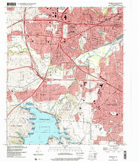
Historical Maps of Fort Worth Through Time
3 maps found