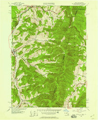
1944 Map of Berlin
USGS Topo · Published 1958About this map
The Little Hoosic River valley forms the primary corridor for settlement and transit along the eastern edge of New York, where the Rutland railroad tracks parallel the water through a string of small communities. The terrain is defined by a series of significant hollows, including Greene Hollow and Mattison Hollow, which cut deep into the Taconic Range toward the Massachusetts and Vermont borders. This 1944 topography captures a landscape of steep elevation changes, punctuated by high points like Berlin Mtn and Sugarloaf Hill.
Find a feature on this map
45 named features on this map. Tap any name to fly to it.
Don’t see what you’re looking for? This feature index may not catch every label — zoom into the map to look around manually.
Map Details
Editions of this 1944 Berlin Map
This is the sole edition of this map. No revisions or reprints were ever made.
Other maps of this area

1886 · Greylock
USGS Topo · 1:62,500

1888 · Berlin
USGS Topo · 1:62,500

1890 · Berlin
USGS Topo · 1:62,500

1891 · Greylock
USGS Topo · 1:62,500

1893 · Greylock
USGS Topo · 1:62,500

1894 · Berlin
USGS Topo · 1:62,500

1897 · Hoosick
USGS Topo · 1:62,500

1898 · Berlin
USGS Topo · 1:62,500

1898 · Bennington
USGS Topo · 1:62,500

1898 · Greylock
USGS Topo · 1:62,500