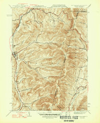
1948 Map of Berlin
USGS Topo · Published 1948About this map
The Rutland railroad corridor anchors the western edge of the Taconic Mountains in the late 1940s, tracing the valley floor between Petersburg and Cherryplain. This region, where New York, Massachusetts, and Vermont converge, is defined by steep ridges and deep hollows that dictated the movement of early settlers and trade. Higher elevations like Berlin Mtn and Jim Smith Hill separate the watershed of the Little Hoosic River from the Green River valley to the east.
Find a feature on this map
46 named features on this map. Tap any name to fly to it.
Don’t see what you’re looking for? This feature index may not catch every label — zoom into the map to look around manually.
Map Details
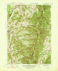
Editions of this 1948 Berlin Map
2 editions found
Other maps of this area

1886 · Greylock
USGS Topo · 1:62,500

1888 · Berlin
USGS Topo · 1:62,500

1890 · Berlin
USGS Topo · 1:62,500

1891 · Greylock
USGS Topo · 1:62,500

1893 · Greylock
USGS Topo · 1:62,500

1894 · Berlin
USGS Topo · 1:62,500

1897 · Hoosick
USGS Topo · 1:62,500

1898 · Berlin
USGS Topo · 1:62,500

1898 · Bennington
USGS Topo · 1:62,500

1898 · Greylock
USGS Topo · 1:62,500