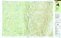
1998 Map of Berlin
USGS Topo · Published 2001About this map
The Little Hoosic River valley carves a central path through this landscape, separating the high ridges of the Taconic Mountain Range from the pond-strewn highlands of Poestenkill and Grafton. The settlement of Berlin sits at the heart of this corridor, supported by civic infrastructure like the Central Sch and Meadow Lawn Cem. The geography here is defined by deep, family-named drainage cuts such as Satterlee Hollow and Greene Hollow that feed into the river from the east, illustrating a classic New York upland settlement pattern where homes and roads followed the narrow valley floors.
Find a feature on this map
81 named features on this map. Tap any name to fly to it.
Don’t see what you’re looking for? This feature index may not catch every label — zoom into the map to look around manually.
Map Details
Editions of this 1998 Berlin Map
This is the sole edition of this map. No revisions or reprints were ever made.
Other maps of this area

1886 · Greylock
USGS Topo · 1:62,500

1888 · Berlin
USGS Topo · 1:62,500

1890 · Berlin
USGS Topo · 1:62,500

1891 · Greylock
USGS Topo · 1:62,500

1893 · Cohoes
USGS Topo · 1:62,500

1893 · Troy
USGS Topo · 1:62,500

1893 · Greylock
USGS Topo · 1:62,500

1894 · Berlin
USGS Topo · 1:62,500

1895 · Troy
USGS Topo · 1:62,500

1895 · Cohoes
USGS Topo · 1:62,500