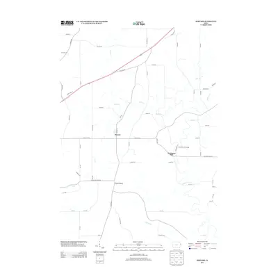
2013 Map of Bernard
USGS Topo · Published 2013About this map
The settlement of Bernard anchors this Dubuque County landscape, where the agricultural grid is defined by a network of family-named roads including Stoffel Rd and Fagan Rd. The terrain is deeply influenced by the winding courses of Lytle Creek and Prairie Creek, which carve through the countryside and support historic crossing points like the Washington Mill Bridge. Near the community of Washington Mills, the convergence of these waterways once dictated the local economy and movement patterns of the region. To the south, the village of Garry Owen sits among a cluster of rural routes, while the western edge is marked by the presence of Lost Creek. This survey captures the enduring character of a rural Iowa community where traditional land divisions meet the irregular natural paths of the local creek systems.
Find a feature on this map
55 named features on this map. Tap any name to fly to it.
Don’t see what you’re looking for? This feature index may not catch every label — zoom into the map to look around manually.
Map Details
Editions of this 2013 Bernard Map
This is the sole edition of this map. No revisions or reprints were ever made.
Other maps of this area

1891 · Maquoketa
USGS Topo · 1:62,500

1891 · Baldwin
USGS Topo · 1:62,500

1901 · Peosta
USGS Topo · 1:125,000

1935 · East Dubuque
USGS Topo · 1:62,500

1940 · East Dubuque
USGS Topo · 1:62,500

1955 · Dubuque South
USGS Topo · 1:24,000

1959 · Dubuque
USGS Topo · 1:250,000

1961 · Dubuque
USGS Topo · 1:250,000

1962 · Dubuque
USGS Topo · 1:250,000

1962 · Zwingle
USGS Topo · 1:24,000