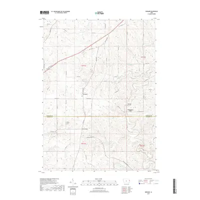
2018 Map of Bernard
USGS Topo · Published 2018About this map
Bernard and the surrounding rural townships of Dubuque and Jackson Counties appear in this modern survey, characterized by a complex network of creeks and ridge-top roads. The landscape is defined by the winding course of Lytle Creek and its tributaries, including Buncombe Cr and N Spring Br, which carve through the Iowa countryside. Historically significant nodes like Garry Owen and Washington Mills represent the enduring small-town footprints of the region. Local history is anchored by sites like Saint Patrick's Cem and the Washington Mill Bridge, which spans the water near the settlement of the same name. Notable thoroughfares such as Twelve Mile Rd and the Bellevue-Cascade Rd trace the path of earlier transport routes, connecting these agricultural communities across the rolling terrain of the Driftless Area outskirts.
Find a feature on this map
52 named features on this map. Tap any name to fly to it.
Don’t see what you’re looking for? This feature index may not catch every label — zoom into the map to look around manually.
Map Details
Editions of this 2018 Bernard Map
This is the sole edition of this map. No revisions or reprints were ever made.
Other maps of this area

1891 · Maquoketa
USGS Topo · 1:62,500

1891 · Baldwin
USGS Topo · 1:62,500

1901 · Peosta
USGS Topo · 1:125,000

1935 · East Dubuque
USGS Topo · 1:62,500

1940 · East Dubuque
USGS Topo · 1:62,500

1955 · Dubuque South
USGS Topo · 1:24,000

1959 · Dubuque
USGS Topo · 1:250,000

1961 · Dubuque
USGS Topo · 1:250,000

1962 · Dubuque
USGS Topo · 1:250,000

1962 · Zwingle
USGS Topo · 1:24,000