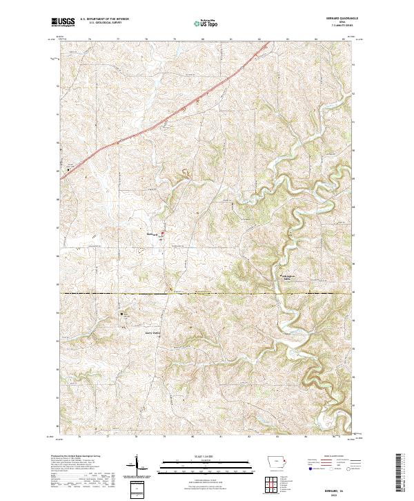
2022 Map of Bernard
USGS Topo · Published 2022About this map
Bernard and the settlement of Garry Owen anchor this portrait of the rural borderlands where Dubuque Co meets Jackson Co. The landscape is defined by the winding paths of Lytle Creek and Prairie Creek, which carve through the undulating topography of eastern Iowa. This survey captures a network of family-named roads and rural infrastructure, including Saint Patricks Cem and Sacred Heart Cem, which serve as vital markers for genealogical research and local history.
Find a feature on this map
59 named features on this map. Tap any name to fly to it.
Don’t see what you’re looking for? This feature index may not catch every label — zoom into the map to look around manually.
Map Details
Editions of this 2022 Bernard Map
This is the sole edition of this map. No revisions or reprints were ever made.
Other maps of this area

1891 · Maquoketa
USGS Topo · 1:62,500

1891 · Baldwin
USGS Topo · 1:62,500

1901 · Peosta
USGS Topo · 1:125,000

1935 · East Dubuque
USGS Topo · 1:62,500

1940 · East Dubuque
USGS Topo · 1:62,500

1955 · Dubuque South
USGS Topo · 1:24,000

1959 · Dubuque
USGS Topo · 1:250,000

1961 · Dubuque
USGS Topo · 1:250,000

1962 · Dubuque
USGS Topo · 1:250,000

1962 · Zwingle
USGS Topo · 1:24,000