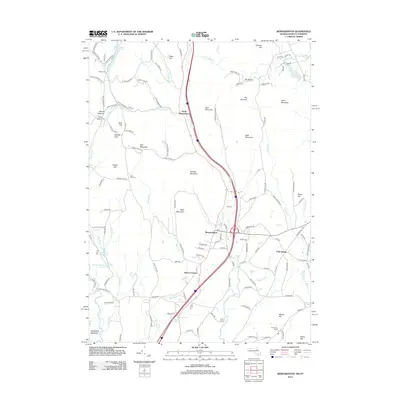
2012 Map of Bernardston
USGS Topo · Published 2012About this map
Bernardston serves as the central hub of this northern Massachusetts landscape, where the Fall River valley carves through a corridor of significant peaks and ridges. The terrain is defined by prominent elevations like Wildcat Mountain, East Mountain, and Bald Mountain to the east, while the western side is marked by Daniels Peak and Frizzell Hill. This 2012 survey illustrates the enduring rural character of the region, featuring several small clusters of activity including North Bernardston and Hales Crossing.
Find a feature on this map
138 named features on this map. Tap any name to fly to it.
Don’t see what you’re looking for? This feature index may not catch every label — zoom into the map to look around manually.
Map Details
Editions of this 2012 Bernardston Map
This is the sole edition of this map. No revisions or reprints were ever made.
Other maps of this area

1887 · Warwick
USGS Topo · 1:62,500

1889 · Warwick
USGS Topo · 1:62,500

1890 · Greenfield
USGS Topo · 1:62,500

1891 · Brattleboro
USGS Topo · 1:62,500

1893 · Brattleboro
USGS Topo · 1:62,500

1894 · Greenfield
USGS Topo · 1:62,500

1894 · Warwick
USGS Topo · 1:62,500

1898 · Keene
USGS Topo · 1:62,500

1932 · Brattleboro
USGS Topo · 1:48,000

1932 · Warwick
USGS Topo · 1:48,000