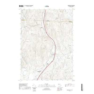
2018 Map of Bernardston
USGS Topo · Published 2018About this map
Bernardston and the northern reaches of Greenfield Town center this 2018 survey, which documents the border between Massachusetts and Vermont. The landscape is defined by the corridor of the Fall River, which flows southward through a valley flanked by significant elevations like Wildcat Mtn and East Mtn. This area preserves its agricultural and rural character, with scattered settlements such as North Bernardston and Hales Crossing connected by a network of named roads like Brattleboro Rd and Eden Trail Br. For those researching local heritage, the map identifies several distinct burial grounds, including the Old Cem and Beaver Meadow Cem. Water management is prominent in the southwest, where the Greenfield Reservoir and Greenfield Reservoir Lower Glen sit along the drainage of Glen Brook, providing a detailed look at the region's hydrography and infrastructure in the early 21st century.
Find a feature on this map
128 named features on this map. Tap any name to fly to it.
Don’t see what you’re looking for? This feature index may not catch every label — zoom into the map to look around manually.
Map Details
Editions of this 2018 Bernardston Map
This is the sole edition of this map. No revisions or reprints were ever made.
Other maps of this area

1887 · Warwick
USGS Topo · 1:62,500

1889 · Warwick
USGS Topo · 1:62,500

1890 · Greenfield
USGS Topo · 1:62,500

1891 · Brattleboro
USGS Topo · 1:62,500

1893 · Brattleboro
USGS Topo · 1:62,500

1894 · Greenfield
USGS Topo · 1:62,500

1894 · Warwick
USGS Topo · 1:62,500

1898 · Keene
USGS Topo · 1:62,500

1932 · Brattleboro
USGS Topo · 1:48,000

1932 · Warwick
USGS Topo · 1:48,000