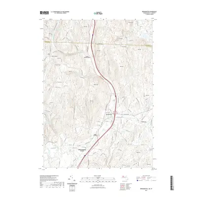
2021 Map of Bernardston
USGS Topo · Published 2021About this map
The town of Bernardston serves as a central hub in this modern topographic study of Franklin County, where the Fall River cuts a prominent valley between East Mtn and West Mtn. This landscape is defined by its transition from the northern reaches of Greenfield Town across the state border into Windham County, Vermont. For those researching local lineages, the map identifies numerous burial sites including East Hill Cem, Baker Cem, and the Old Cem near the town center. The presence of Hales Crossing and Cold Spring indicates long-standing rural neighborhoods, while the elevations of Wildcat Mtn and Bald Mtn overlook a complex network of brooks and ponds. Significant water features such as the Greenfield Reservoir and Newell Pond underscore the area's ongoing importance for local water management and recreation.
Find a feature on this map
124 named features on this map. Tap any name to fly to it.
Don’t see what you’re looking for? This feature index may not catch every label — zoom into the map to look around manually.
Map Details
Editions of this 2021 Bernardston Map
This is the sole edition of this map. No revisions or reprints were ever made.
Other maps of this area

1887 · Warwick
USGS Topo · 1:62,500

1889 · Warwick
USGS Topo · 1:62,500

1890 · Greenfield
USGS Topo · 1:62,500

1891 · Brattleboro
USGS Topo · 1:62,500

1893 · Brattleboro
USGS Topo · 1:62,500

1894 · Greenfield
USGS Topo · 1:62,500

1894 · Warwick
USGS Topo · 1:62,500

1898 · Keene
USGS Topo · 1:62,500

1932 · Brattleboro
USGS Topo · 1:48,000

1932 · Warwick
USGS Topo · 1:48,000