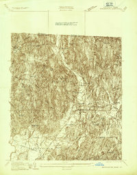
1936 Map of Bernardston
USGS Topo · Published 1936About this map
The borderlands of Vermont and Massachusetts are defined here by the steep, wooded heights of Wild Cat Mtn and Bald Mtn during the mid-1930s. The village of Bernardston serves as a central hub, where the Boston and Maine Railroad meets the valley floor and provides transit via Bernardston Station. The landscape is dotted with a high density of rural schoolhouses, including Beaver Meadow Sch and Sunnyside Sch, reflecting a distributed early-20th-century population pattern that relied on local neighborhood education centers.
Find a feature on this map
39 named features on this map. Tap any name to fly to it.
Don’t see what you’re looking for? This feature index may not catch every label — zoom into the map to look around manually.
Map Details
Editions of this 1936 Bernardston Map
This is the sole edition of this map. No revisions or reprints were ever made.
Other maps of this area

1887 · Warwick
USGS Topo · 1:62,500

1889 · Warwick
USGS Topo · 1:62,500

1890 · Greenfield
USGS Topo · 1:62,500

1891 · Brattleboro
USGS Topo · 1:62,500

1893 · Brattleboro
USGS Topo · 1:62,500

1894 · Greenfield
USGS Topo · 1:62,500

1894 · Warwick
USGS Topo · 1:62,500

1898 · Keene
USGS Topo · 1:62,500

1932 · Brattleboro
USGS Topo · 1:48,000

1932 · Warwick
USGS Topo · 1:48,000