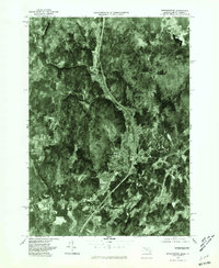
1975 Map of Bernardston
USGS Topo · Published 1981About this map
Bernardston serves as the central hub of this mid-1970s orthophotograph, where the developed landscape of the town center contrasts with the dense woodlands of Franklin County. This unique imagery, produced by the U.S. Geological Survey in cooperation with the Massachusetts Department of Public Works, provides a literal view of the land as it appeared during the autumn of 1975. The Fall River carves a distinct valley through the center of the sheet, dictated by the sharp topography of the region. Local researchers can trace the development patterns of North Bernardston and Hales Crossing, or examine the water levels at Lily Pond. The map also captures the course of the Green River along the western edge and the northern reaches of Gill to the southeast, showing how transportation routes and settlements were carved into the wooded hillsides of northern Massachusetts.
Find a feature on this map
7 named features on this map. Tap any name to fly to it.
Don’t see what you’re looking for? This feature index may not catch every label — zoom into the map to look around manually.
Map Details
Editions of this 1975 Bernardston Map
This is the sole edition of this map. No revisions or reprints were ever made.
Other maps of this area

1887 · Warwick
USGS Topo · 1:62,500

1889 · Warwick
USGS Topo · 1:62,500

1890 · Greenfield
USGS Topo · 1:62,500

1891 · Brattleboro
USGS Topo · 1:62,500

1893 · Brattleboro
USGS Topo · 1:62,500

1894 · Greenfield
USGS Topo · 1:62,500

1894 · Warwick
USGS Topo · 1:62,500

1898 · Keene
USGS Topo · 1:62,500

1932 · Brattleboro
USGS Topo · 1:48,000

1932 · Warwick
USGS Topo · 1:48,000