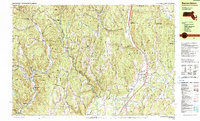
1990 Map of Bernardston
USGS Topo · Published 1990About this map
The colonial frontier and industrial growth of the late 20th century converge along the Massachusetts-Vermont border in this detailed topographic study. The landscape preserves the memory of early defense, marking the historical locations of Fort Morrison (Site), Fort Lucas (Site), and Fort Morris (Site) near Colrain. These sites, established during the mid-18th century as a line of defense, sit near the winding course of the North River and its branches. By 1990, the region transitioned from its early fort-based settlements to a collection of mill villages and rural townships like Griswoldville, Foundry Village, and Lyonsville.
Find a feature on this map
118 named features on this map. Tap any name to fly to it.
Don’t see what you’re looking for? This feature index may not catch every label — zoom into the map to look around manually.
Map Details
Editions of this 1990 Bernardston Map
2 editions found
Other maps of this area

1886 · Hawley
USGS Topo · 1:62,500

1887 · Warwick
USGS Topo · 1:62,500

1889 · Warwick
USGS Topo · 1:62,500

1889 · Wilmington
USGS Topo · 1:62,500

1890 · Hawley
USGS Topo · 1:62,500

1890 · Greenfield
USGS Topo · 1:62,500

1891 · Wilmington
USGS Topo · 1:62,500

1891 · Brattleboro
USGS Topo · 1:62,500

1893 · Brattleboro
USGS Topo · 1:62,500

1894 · Greenfield
USGS Topo · 1:62,500