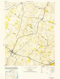
1953 Map of Berryville
USGS Topo · Published 1953About this map
Berryville serves as the focal point for this mid-century survey of the Shenandoah Valley, where the state line between West Virginia and Virginia bisects a landscape defined by rolling agricultural tracts and early industrial sites. The area is heavily influenced by the presence of two major rail lines, the Baltimore and Ohio and the Norfolk and Western, which facilitated the movement of goods and people between rural outposts like Summit Point and Rippon. Local life is anchored by social centers such as Beulah Church, Marvin Chapel, and Bethel Church. The hydrography of the region is notably complex, with numerous springs and runs such as Logg Marsh Run and Bullskin Run feeding into the Shenandoah River. Insight into the local economy is provided by landmarks like Feagans Mill, while survey markers like USC&GS Rippon 1942 indicate the rigorous mapping efforts of the era.
Find a feature on this map
32 named features on this map. Tap any name to fly to it.
Don’t see what you’re looking for? This feature index may not catch every label — zoom into the map to look around manually.
Map Details
Editions of this 1953 Berryville Map
This is the sole edition of this map. No revisions or reprints were ever made.
Other maps of this area

1884 · Harpers Ferry
USGS Topo · 1:125,000

1891 · Harpers Ferry
USGS Topo · 1:125,000

1893 · Harpers Ferry
USGS Topo · 1:125,000

1894 · Winchester
USGS Topo · 1:125,000

1914 · Martinsburg
USGS Topo · 1:48,000

1914 · Gerrardstown
USGS Topo · 1:48,000

1916 · Gerrardstown
USGS Topo · 1:62,500

1916 · Martinsburg
USGS Topo · 1:62,500

1916 · Berryville
USGS Topo · 1:62,500

1937 · Gerrardstown
USGS Topo · 1:48,000