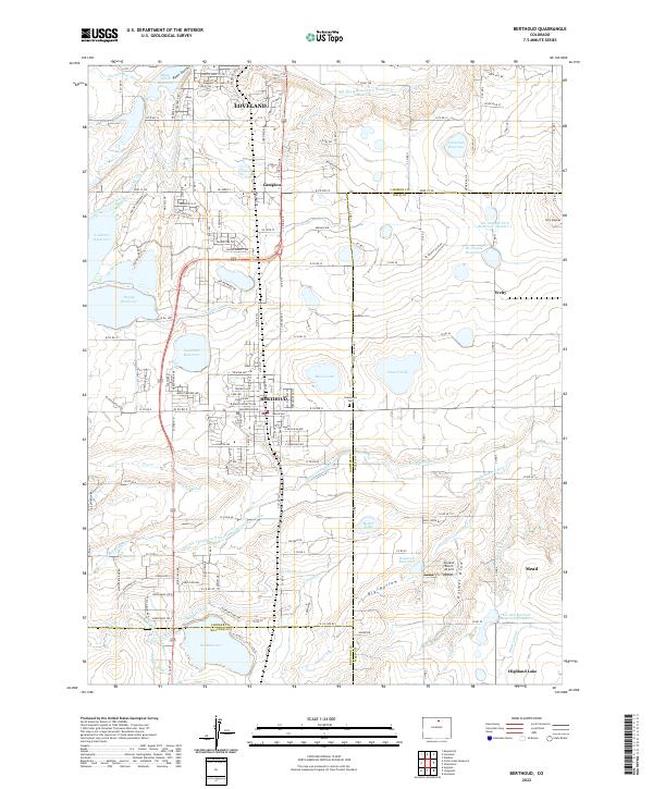
2022 Map of Berthoud
USGS Topo · Published 2022About this map
Berthoud sits at the heart of this landscape, surrounded by an intricate network of irrigation systems and agricultural water management. The complex hydrology of the Front Range is evident in the numerous waterways such as George Rist Ditch, Handy Ditch, and Rockwell Ditch, which redirect water from the Little Thompson River to support the surrounding plains. The presence of specialized infrastructure like the Skylane Ranch Airport and several large reservoirs, including Lonetree Reservoir and Ide and Starbird Reservoir Number 2, illustrates the intersection of mid-century aviation and long-standing water rights. To the north, the southern edges of Loveland and the community of Campion appear, while Mead and the Greenlawn Cem provide important local landmarks for genealogists and regional historians. This survey documents the region's managed landscape, where local drainage features like Big Hollow and Holmes Draw define the underlying topography.
Find a feature on this map
166 named features on this map. Tap any name to fly to it.
Don’t see what you’re looking for? This feature index may not catch every label — zoom into the map to look around manually.
Map Details
Editions of this 2022 Berthoud Map
This is the sole edition of this map. No revisions or reprints were ever made.