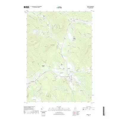
2018 Map of Bethel
USGS Topo · Published 2018About this map
The Androscoggin River carves a central valley through the western Maine highlands, serving as the primary corridor for settlements like Newry, Mayville, and Bethel. This river-centric geography is reflected in the concentration of infrastructure along the valley floor, including the Bethel Regional Airport and numerous historical burial grounds. The surrounding terrain is defined by significant elevations such as Barker Mtn, Locke Mtn, and Sparrowhawk Mtn, which create a dramatic backdrop for the smaller hamlets.
Find a feature on this map
118 named features on this map. Tap any name to fly to it.
Don’t see what you’re looking for? This feature index may not catch every label — zoom into the map to look around manually.
Map Details
Editions of this 2018 Bethel Map
This is the sole edition of this map. No revisions or reprints were ever made.
Other maps of this area

1911 · Bryant Pond
USGS Topo · 1:62,500

1914 · Bethel
USGS Topo · 1:62,500

1914 · Bryant Pond
USGS Topo · 1:62,500

1927 · Rumford
USGS Topo · 1:48,000

1930 · Rumford
USGS Topo · 1:62,500

1940 · Bethel
USGS Topo · 1:62,500

1941 · Bethel
USGS Topo · 1:62,500

1942 · Bryant Pond
USGS Topo · 1:62,500

1943 · Old Speck Mtn
USGS Topo · 1:62,500

1945 · Old Speck Mtn
USGS Topo · 1:62,500